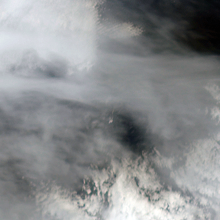
The tiny Aleutian island of Bogoslof in Alaska, erupting regularly since December 2016, produced fresh activity on Sunday, May 28, 2017. Bogoslof is a stratovolcano fueled by the subduction of the Pacific Plate under the North American Plate and forms part of the larger Aleutian Arc, which includes more than 60 volcanoes on the Aleutian Islands and the Aleutian Range on the Alaska mainland. Previous to its recent period of activity, Bogoslof had last erupted in 1992, and its above-water surface area was a mere 0.11 square miles (0.29 square kilometers). As of March 11, the most recent data available, the area of the island had tripled to 0.38 square miles (0.98 square kilometers). The event on May 28 produced an ash cloud that reached 40,000 feet (12 km) in altitude, causing the Alaskan Volcano Observatory to issue a red alert for air travel in the area. Volcanic ash can cause major damage to aircraft engines, and the region is close to several major air routes between North America and Asia.
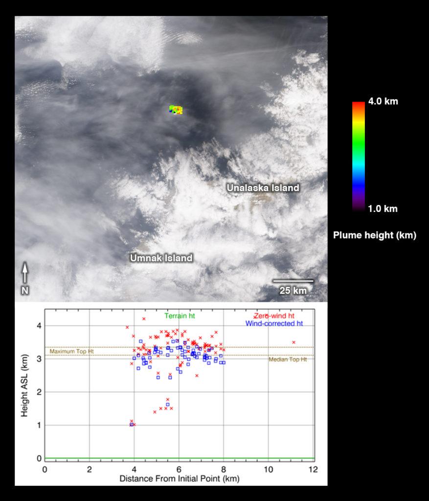
On May 28, 2017, at approximately 2:23 p.m. local time, NASA’s Terra satellite passed over Bogoslof, less than 10 minutes after the eruption began. MISR has nine cameras that view Earth at different angles. It takes slightly less than seven minutes for all nine cameras to view the same location on Earth. On the left, an animation made from the images from the nine MISR cameras, captured between 2:19 and 2:26 p.m., demonstrates how the angled views give a glimpse of the underside of the growing plume of volcanic ash, showing the eruption column widening into the cloud at the top.
Data from MISR’s nine cameras can also be used to calculate the height of the plume, based on the apparent movement of the cloud from one camera to another. On the right, a map of plume height is plotted over the downward-looking image. The top of the cloud was approximately 10,000 feet (3 kilometers) high at this time. Below the image is a scatterplot of the heights, with blue points representing heights corrected by the northwesterly winds reported by the Alaskan Volcano Observatory during the eruption, and red points representing uncorrected heights. Lower points at either side of the plume represent retrievals of the eruption column.
These data were captured during Terra orbit 92786. The stereoscopic analysis was performed using the MISR INteractive eXplorer (MINX) software tool, which is publicly available through the Open Channel Foundation at https://www.openchannelsoftware.com/projects/MINX. Other MISR data are available through the NASA Langley Research Center; for more information, go to https://eosweb.larc.nasa.gov/project/misr/misr_table. MISR was built and is managed by NASA’s Jet Propulsion Laboratory in Pasadena, California, for NASA’s Science Mission Directorate in Washington, D.C. The Terra spacecraft is managed by NASA’s Goddard Space Flight Center in Greenbelt, Maryland. The MISR data were obtained from the NASA Langley Research Center Atmospheric Science Data Center in Hampton, Virginia. JPL is a division of the California Institute of Technology in Pasadena.
Credit: NASA/GSFC/LaRC/JPL-Caltech, MISR Team, article by Abbey Nasten


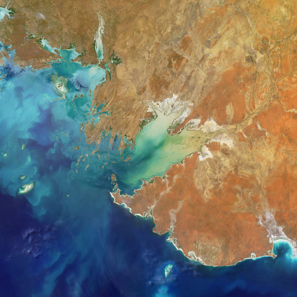 Are you ready for a challenge? Become a geographical detective and solve the latest mystery quiz from NASA’s MISR (Multi-angle Imaging SpectroRadiometer) instrument onboard the Terra satellite. Prize submissions for perfect scores accepted until Wednesday, June 28, at 4:00 p.m. PDT. Happy sleuthing!
 NASA climate scientist Ralph Kahn presented a Maniac lecture at Goddard Space Flight Center entitled, “The Stories Data Tell.” At an early age, Ralph found that separating causality from coincidence can be the lynchpin of understanding, and at times can help identify prerogatives or highlight the path toward the better options. Ralph shared his experiences, professional, personal, and at the intersection of the two, where the difference seemed to matter. And how data can help address this challenge, providing evidence one way or the other – sometimes!