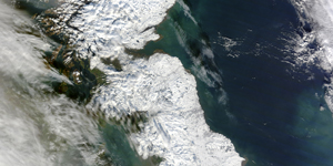
MODIS website informs a broad audience about MODIS data and products.
The MODIS instrument is operating on both the Terra and Aqua spacecraft. It has a viewing swath width of 2,330 km and views the entire surface of the Earth every one to two days. Its detectors measure 36 spectral bands between 0.405 and 14.385 µm, and it acquires data at three spatial resolutions — 250m, 500m, and 1,000m.
Along with all the data from other instruments on board the Terra spacecraft and Aqua Spacecraft, MODIS data are transferred to ground stations in White Sands, New Mexico, via the Tracking and Data Relay Satellite System (TDRSS). The data are then sent to the EOS Data and Operations System (EDOS) at the Goddard Space Flight Center. The Level 1A, Level 1B, geolocation and cloud mask products and the Higher-level MODIS land and atmosphere products are produced by the MODIS Adaptive Processing System (MODAPS), and then are parceled out among three DAACs for distribution. Ocean color products are produced by the Ocean Color Data Processing System (OCDPS) and distributed to the science and applications community.
The many data products derived from MODIS observations describe features of the land, oceans and the atmosphere that can be used for studies of processes and trends on local to global scales. As just noted, MODIS products are available from several sources. MODIS Level 1 and atmosphere products are available through the LAADS web. Land Products are available through the Land Processes DAAC at the U. S. Geological Survey EROS Data Center (EDC). Cryosphere data products (snow and sea ice cover) are available from the National Snow and Ice Data Center (NSIDC) in Boulder, Colorado. Ocean color products and sea surface temperature products along with information about these products are obtainable at the OCDPS at GSFC. Users with an appropriate x-band receiving system may capture regional data directly from the spacecraft using the MODIS Direct Broadcast signal.
More information about obtaining MODIS data can be found from the information sites listed below.
- MODIS level 1 data, geolocation, cloud mask, and atmosphere products
- MODIS land products
- MODIS cryosphere products
- MODIS ocean color and sea surface temperature products
MODIS Data Ordering Tools – Listed are a variety of tools and resources that can be utilized with MODIS Data. Each listing provides a link to the tool or resource and a short summary of its use.
MODIS Data Products For Novice Data Users
- NASA Worldview – Visually explore the past and the present of this dynamic planet from a satellite’s perspective. Select from an array of stories below to learn more about Worldview, the satellite imagery we provide and events occurring around the world.
MODIS Data Products Information For Professional Data Users
- MODIS Data Products – detailed descriptions and ordering information listed with product)
- MODIS Algorithms
- MODIS Direct Broadcast Centers – the Terra MODIS instrument was one of the first satellites to constantly broadcast data for anyone with the right equipment and software to download, free of charge


