

The MOPITT website informs a broad audience about MOPITT data and products.
MOPITT data are are available from several archives:
- Earthdata (V7 and V8, Level 2 and Level 3)
- Giovanni (V7 Level 3)
- ASDC Data Pool by ftp (V7 and V8, Level 2 and Level 3)
- ASDC Data Pool by OPeNDAP (V7 and V8, Level 2 and Level 3)
- ASDC MOPITT Subsetter (V8 Level 2)
MOPITT Data Products For Novice Data Users
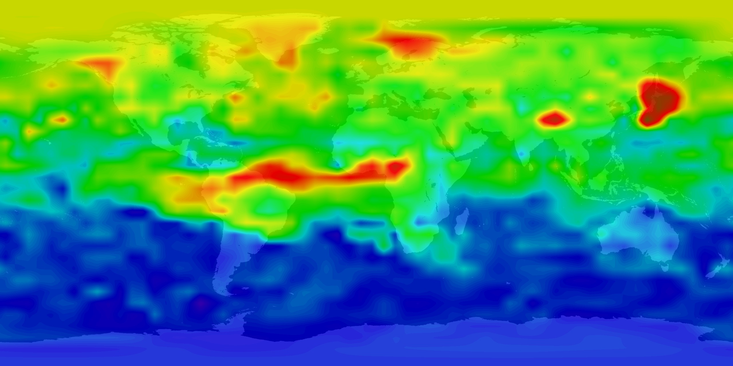
- MOPITT Product Visualization – Pre-generated plots show global distributions of carbon monoxide for specific days or months of the Terra mission available through the MOPITT website.
- NASA Worldview – Interactive interface for browsing full-resolution, global, daily satellite images, including MOPITT data sets.
MOPITT Data Products For Professional Data Users
Scientists and researchers can access version 4,5, and 6 are currently publicly available.
- MOPITT Data Products (detailed descriptions listed with product)
- MOPITT Data User’s Guides (recommended for scientists)
- MOPITT Product Visualization – Pre-generated plots show global distributions of carbon monoxide for specific days or months of the Terra mission available through the MOPITT website. Advanced users benefit from using these plots to quickly identify potentially interesting geographical areas for analysis, such as regions where large-scale biomass burning might be taking place.