↓ Skip to Main Content
NASA
|
Earth Observatory
|
Terra in Visible Earth
The EOS Flagship
About
Mission
Terra Instruments
ASTER
CERES
MISR
MODIS
MOPITT
Science
Applications
Atmosphere
Carbon Cycle and Ecosystems
Climate Variability and Change
Earth’s Surface & Interior
Water & Energy Cycle
Weather
Data
ASTER Data
CERES Data
MISR Data
MODIS Data
MOPITT Data
Multimedia
TERRA Images
Videos
Podcasts
News
Resources
For Data Users
For Educators
For Everyone
All Resources
Leadership
Dr. Kurtis Thome
Dr. David J. Diner
Dr. James R. Drummond
Dr. Michael D. King
Mr. Michael J. Abrams
Dr. Norman G. Loeb
Dr. Si-Chee Tsay
Mr. Robert Wolfe
Mr. Wynn J. Watson
Dr. Nyssa Rayne
☰ Main Menu
About
Mission
Terra Instruments
ASTER
CERES
MISR
MODIS
MOPITT
Science
Applications
Atmosphere
Carbon Cycle and Ecosystems
Climate Variability and Change
Earth’s Surface & Interior
Water & Energy Cycle
Weather
Data
ASTER Data
CERES Data
MISR Data
MODIS Data
MOPITT Data
Multimedia
TERRA Images
Videos
Podcasts
News
Resources
For Data Users
For Educators
For Everyone
All Resources
Leadership
Dr. Kurtis Thome
Dr. David J. Diner
Dr. James R. Drummond
Dr. Michael D. King
Mr. Michael J. Abrams
Dr. Norman G. Loeb
Dr. Si-Chee Tsay
Mr. Robert Wolfe
Mr. Wynn J. Watson
Dr. Nyssa Rayne
Terra Instruments:
ASTER
CERES
MISR
MODIS
MOPITT
Multimedia
Images
Podcasts
Videos
Terra at Ten Presentations
Features
Home
›
Multimedia
›
Images
Images
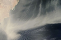
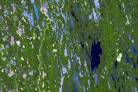
MODIS: Image of the Day
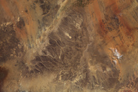
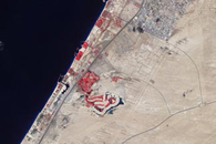
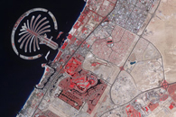
ASTER: Featured Image
MISR: Where On Earth?
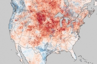
Visible Earth
Terra at Ten
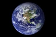
Terra Blue Marble
Earth Observatory:
World of Change
NASA Earth Observations