

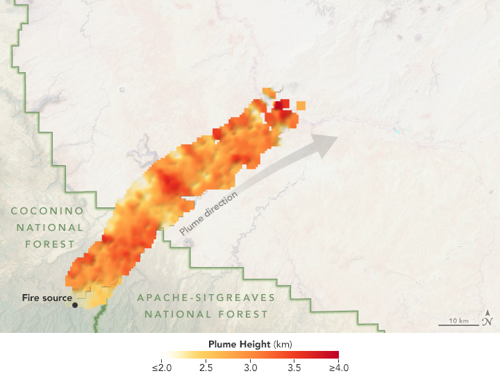
MISR with it’s multiple angled views of the Tinder fire, makes it uniquely capable of tracking the plume height and direction of one of the first fires of the 2018 season in the United States. The fire started on April 27th, 2018 from an abandoned campsite and quickly spread through, Cococino National Forest in, eastern Arizona. This MISR data is from April 30th, 2018, showing the plume height and direction. The plume reached nearly 4 kilometers high near the source of the fire. Typically the higher a plume reaches, the further the impact extends. Scientists are using data like this to better understand how fires impact air quality beyond the source area.
Read more:
Using Satellites to Track the Tinder Fire on NASA Earth Observatory
Tinder Fire in Arizona Viewed by NASA’s MISR from JPL’s Photojournal