July 24, 2016
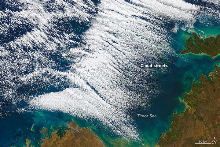
These “streets of the sky” called cloud streets are long parallel bands of cumulus clouds. On July 15, 2016, the Moderate Resolution Imaging Spectroradiometer (MODIS) on NASA’s Terra satellite aquired these images of cloud streets off the northern coast of Australia. Read more on NASA’s Earth Observatory.
Swirls of Ice in the Labrador Sea
July 21, 2016
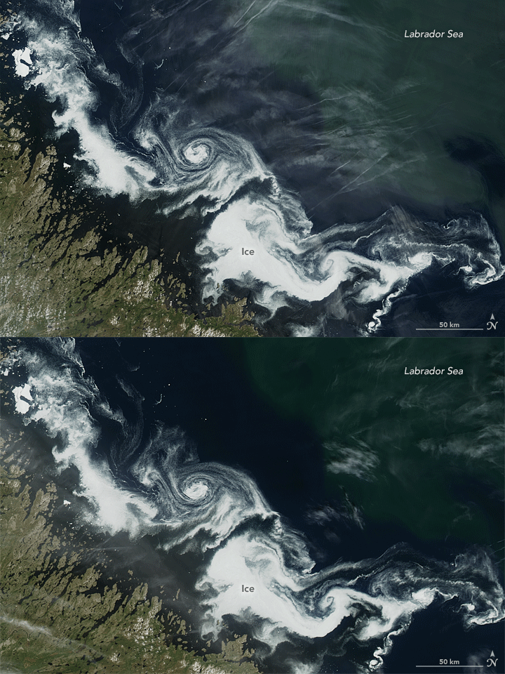
What first appeared to be a storm wasn’t a low pressure system in the clouds, but a swirling mass of ice in the sea. The Moderate Resolution Imaging Spectroradiometer (MODIS) on NASA’s Terra and Aqua satellites acquired views of an ice eddy off the coast of Labrador, Canada, on July 2, 2016. Read more on NASA’s Earth Observatory.
Caterpillars Take Bite Out of Rhode Island Forests
July 15, 2016
Gypsy moth caterpillars damaged parts of New England’s forests and the damage is extensive enough to be seen from space. The Moderate Imaging Spectroradiomenter on NASA’s Terra satellite captured images of the damage over Rhode Island, Massachussetts and Connecticut during the pests’ population boom in the summer of 2016. Read more on NASA’s Earth Observatory.
Making Waves in the Sky off of Africa
July 14 , 2016
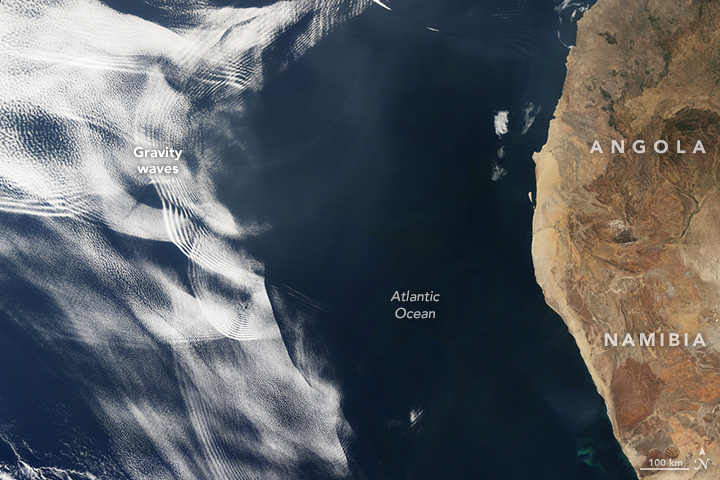
On June 26, 2016, the Moderate Resolution Imaging Spectroradiometer (MODIS) on NASA’s Terra satellite acquired this natural-color image of cloud gravity waves off the coast of Angola and Namibia. Learn more about this phenomenon on NASA’s Earth Observatory.
July 12, 2016
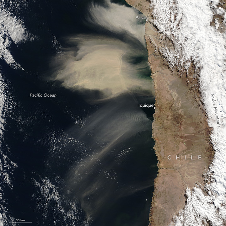
Large amounts of dust were airborne off the west coast of South America. This is not a typical location dust events such as this one. The Moderate Resolution Imaging Spectroradiometer (MODIS) on NASA’s Terra satellite acquired this image of airborne dust off the coast of Chile, on July 8, 2016. Read more on NASA’s Earth Observatory.
July 2, 2016
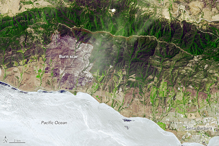
The Sherpa fire west of Santa Barbara, California was contained before it caused damage to homes or infrastructure. However, it still charred several thousand acres as of June 29. The Advanced Spaceborne Thermal Emission and Reflection Radiometer (ASTER) on the Terra satellite acquired an image of the burn scar on June 19, 2016. Read more on NASA’s Earth Observatory.


