Month: June 2016

caspiansea_amo_2016158

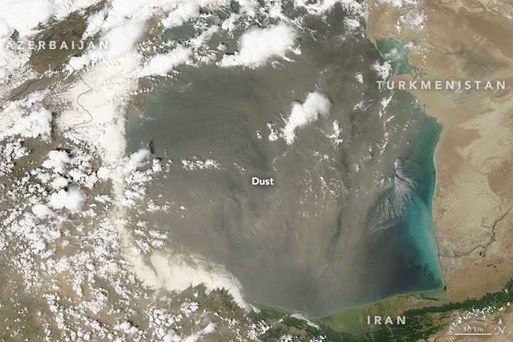
Does Dust Affect Water Levels of the Caspian Sea

June 10, 2016

Dust storms over the Caspian Sea lead to increased evaporation and a drop in lake level according to new research using observations of dust collected by instruments on several satellites including the Moderate Imaging Spectroradiometer (MODIS ) and the Multi-angle Imaging Spectroradiometer (MISR) on Terra.

ruapehu_ast_2016111

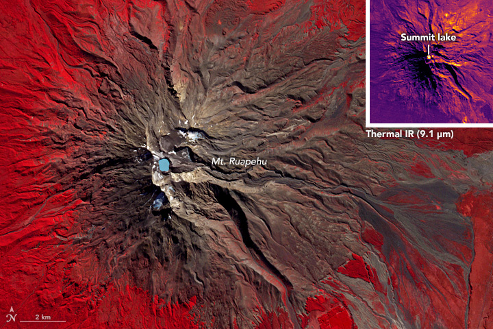
A Satellite Eye on Mount Ruapehu

June 5, 2010

Mount Ruapehu is one of New Zealand’s most active volcanoes and most visited, dotted with skiers and snowboarders along its slopes.  When it erupts lahars, flows of volcanic debris and sediment, can have devastating impacts, prompting geologists to regularly monitor the volcano, using the Advanced Spaceborne Thermal Emission and Reflection Radiometer on NASA’s Terra satellite.


roanu_tmo_2016142

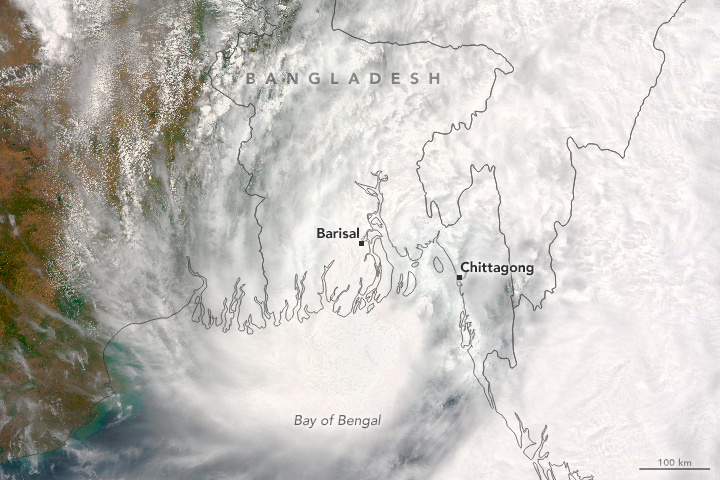
The Rains of Roanu

May 24, 2016 

Tropical Storm Roanu made landfall in Bangladesh, unleashing heavy winds and rain on the country’s populous coastal communities. On May 21, 2016, the Moderate Resolution Imaging Spectroradiometer (MODIS) on NASA’s Terra satellite acquired this natural-color image of the storm. Roanu progressed northeast over the Bay of Bengal before making landfall in Bangladesh.


beaufort_tmo_2014092-2016117

Early Breakup of the Beaufort Sea Ice 

May 20, 2016 

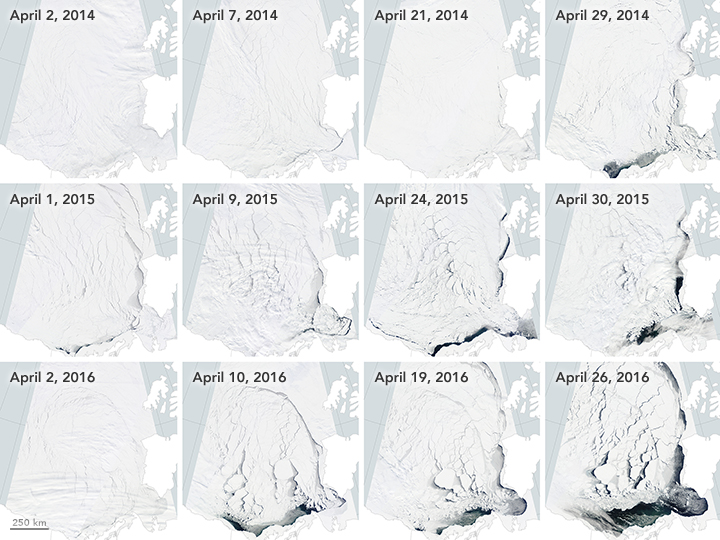
The Beaufort Sea ice pack starts to thin and break up in spring when temperatures begin to rise, usually in late May. However, much of the Beaufort Sea’s ice had already broken by mid-April. Images from the Moderate Imaging Spectroradiometer (MODIS) on NASA’s Terra satellite captured the progression in April in 2014, 2015, and 2016.


greenlandlsta_tmo_201604

Widespread Warmth Envelops Greenland 

May 18, 2016

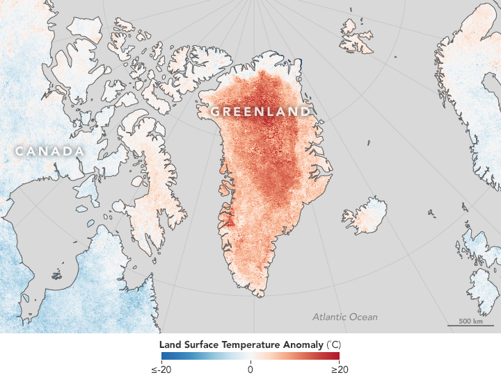
Land surface temperature data from the Moderate Imaging Spectroradiometer on NASA’s Terra satellite shows a much warmer than average April in Greenland.


canadalsta_tmo_2016126

Heat Fuels Fire at Fort McMurray

May 7, 2016 

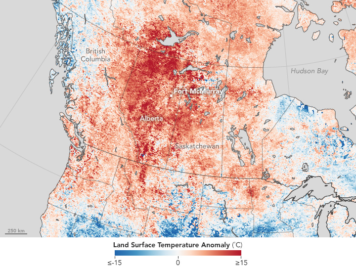
Land surface data from the Moderate Resolution Imaging Spectroradiometer showed increased land surface temperatures near Fort McMurray in Northern Alberta, Canada, where a destructive wildfire burned.


thailandlsta_tmo_201604

Heat Wave Hits Thailand, India

May 4, 2016

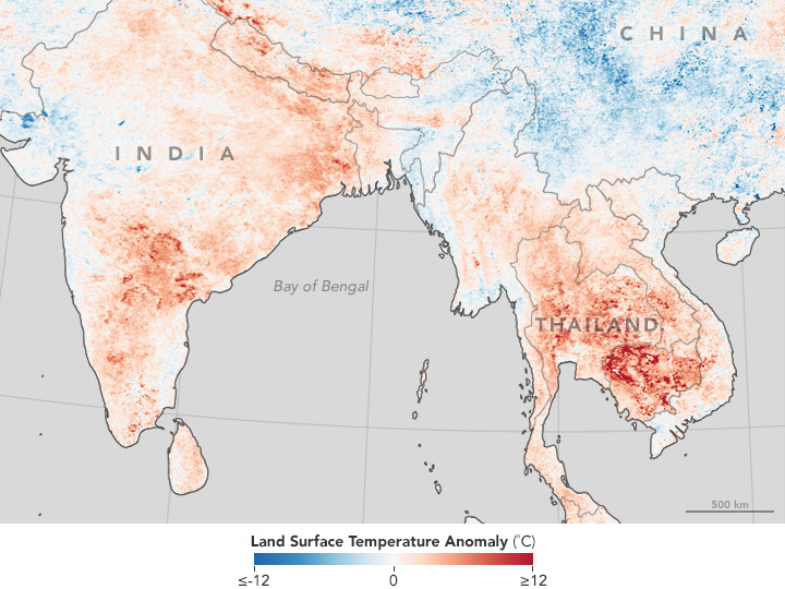
Land surface temperature map based on data from the Moderate Imaging Spectroradiometer on NASA’s Terra satellite shows a warmer than average Southeast Asia in April.