Image from TERRA
Tue, 18 Apr 2023 16:24 EDT

The Valley of Ten Thousand Smokes, located in Katmai National Park, forms a unique and ashen landscape. Encircled by volcanoes – both active and inactive – it has served as a perfect collection area for huge amounts of volcanic ash.

Image from TERRA
Tue, 20 Sep 2022 10:30 EDT

Water departments in the West are using maps and models originally created by a NASA team to help track water.

Image from TERRA
Thu, 15 Sep 2022 10:00 EDT

NASA and Google broadened an existing partnership to help local governments improve their monitoring and prediction of air quality for better decision making.

MISR Views Kilauea


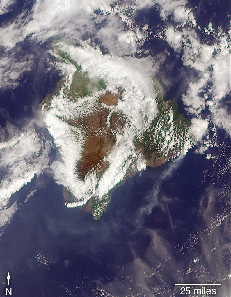
On May 6, 2018 as Kilauea continued to erupt, MISR passed overhead at approximately 11 a.m. local time, capturing this view of the island. While much of the island is covered by clouds, the eruption plume is visible streaming southwest over the ocean starting at the fissure on Hawaii’s eastern point. MISR uses it’s unique, nine-angle view to calculate plume height. This image is from one of MISR’s forward pointing cameras. The plume height is relatively low, meaning that gas and ash are staying near the ground, potentially causing health risks from poor air quality downwind.

Read more:


Ash from Kilauea Eruption Viewed by NASA’s MISR on NASA JPL’s Photojournal


Tagged with: ,