Image from TERRA
Tue, 18 Apr 2023 16:24 EDT

The Valley of Ten Thousand Smokes, located in Katmai National Park, forms a unique and ashen landscape. Encircled by volcanoes – both active and inactive – it has served as a perfect collection area for huge amounts of volcanic ash.

Image from TERRA
Tue, 20 Sep 2022 10:30 EDT

Water departments in the West are using maps and models originally created by a NASA team to help track water.

Image from TERRA
Thu, 15 Sep 2022 10:00 EDT

NASA and Google broadened an existing partnership to help local governments improve their monitoring and prediction of air quality for better decision making.

ASTER Views Kilauea

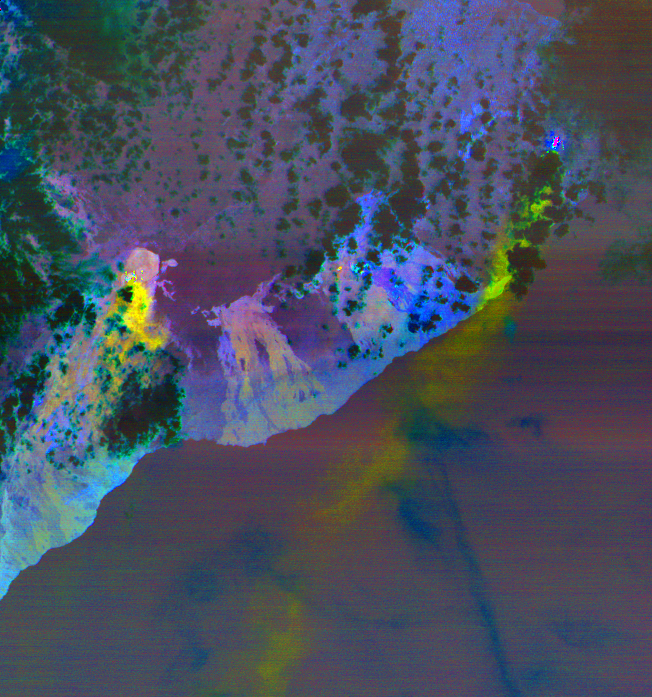
When volcanoes erupt, ASTER turns its attention to documenting the changes to the landscape as they happen. ASTER is uniquely capable of turning to see areas where volcanoes are erupting in very high resolution (between 15 in the thermal bands – 90 meter spatial resolution in the visible light spectral bands).

As Hawaii’s Kilauea continues to erupt, ASTER continues to monitor the eruption from space. This image from May 6, 2018 shows the sulfur dioxide being released from the volcano in yellow and yellow-green.

Read more:

Satellite View of Kilauea Eruption from NASA JPL


Tagged with: ,