Tag: Atmosphere

Atmosphere News and Events

Measurements Of Pollution In The Troposphere (MOPITT) instrument on board NASA’s Terra satellite measures carbon monoxide (CO) in the troposphere, the lowest portion of Earth’s atmosphere, ranging from sea level up to 20 km at the equator and 7 km near the poles. There are few in situ profiles, measurements that are taken from the natural position rather than remotely, that reach into the upper troposphere (UT), limiting understanding of MOPITT performance at that atmospheric level. It is important for any data collected by satellites to be validated against other existing data to ensure that the information being collected is accurate and applicable.

In a recent poster presented at the American Geophysical Union Conference, MOPITT CO levels were validated and contrasted by the Fourier Transform Spectrometer on board the Atmospheric Chemistry Experiment (ACE-FTS), from the Canadian Space Agency and the Quantum Cascade Laser Spectrometer on the HIAPER Pole to Pole Observations experiment (HIPPO-QCLS).  ACE-FTS has been monitoring the upper troposphere since 2004, providing data for much of the same time as MOPITT and HIPPO-QCLS data has high resolution, precision, and accuracy from its in situ measurements, making it an ideal source for validating the MOPITT measurements.

NASA image courtesy Jeff Schmaltz, LANCE/EOSDIS MODIS Rapid Response Team at NASA GSFC. Caption by Holli Riebeek with interpretation by Kerry Meyer.

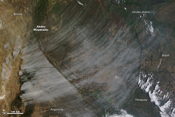
The view shown in this image is rare: a high bank of cirrus clouds sweeps east from the Andes Mountains of South America in otherwise clear skies. Under normal circumstances, other clouds would dominate the scene.

The Moderate Resolution Imaging Spectroradiometer (MODIS) on NASA’s Terra satellite acquired the image on September 20, 2013, when strong upper level winds were blowing east across South America. Read more

NASA image courtesy Jeff Schmaltz, LANCE/EOSDIS MODIS Rapid Response Team at NASA GSFC. Caption by Holli Riebeek with interpretation by Kerry Meyer.

The Advanced Spaceborne Thermal Emission and Reflection Radiometer (ASTER) on NASA’s Terra satellite captured this false-color image of the Rim fire burning in and near Yosemite National Park on August 30, 2013. The image, based on ASTER’s observations of visible and infrared light, highlights the contrast between burned and unburned vegetation. Unburned vegetation appears bright red, whereas burned areas are gray. Thick plumes of smoke are also visible billowing from the fire. Read more

In early April 2013, clouds stretched in parallel rows for hundreds of kilometers over the Bering Sea. The Moderate Resolution Imaging Spectroradiometer (MODIS) on NASA’s Terra satellite captured this natural-color image of the phenomenon on April 7, 2013. Read more

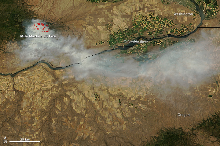
On July 27, 2013, the Moderate Resolution Imaging Spectroradiometer (MODIS) on NASA’s Terra satellite captured this image of the Mile Marker 28 fire burning about 15 miles northeast of Goldendale, Washington. Red outlines indicate hot spots where MODIS detected unusually warm surface temperatures associated with fire. The lower image, a photograph taken by a firefighter on the Washington Incident Management Team 2, shows a column of smoke billowing from the blaze on July 28. Read more