Tag: Atmosphere

Atmosphere News and Events

NASA image courtesy Jeff Schmaltz, LANCE MODIS Rapid Response. Caption by Adam Voiland.

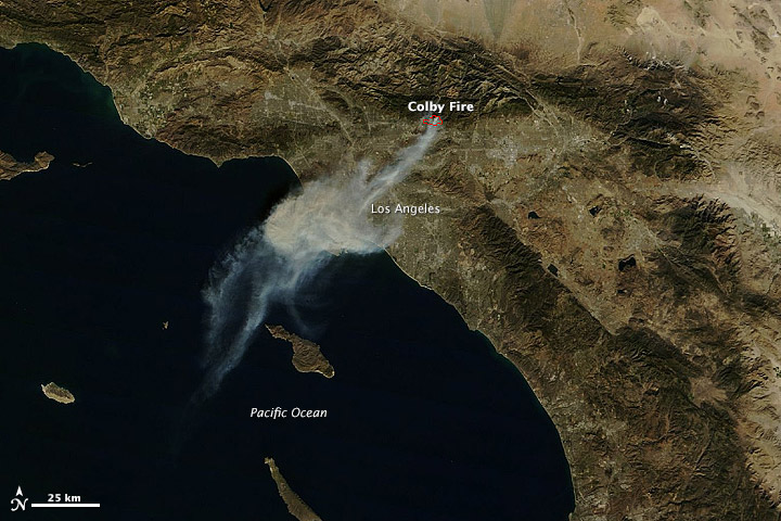
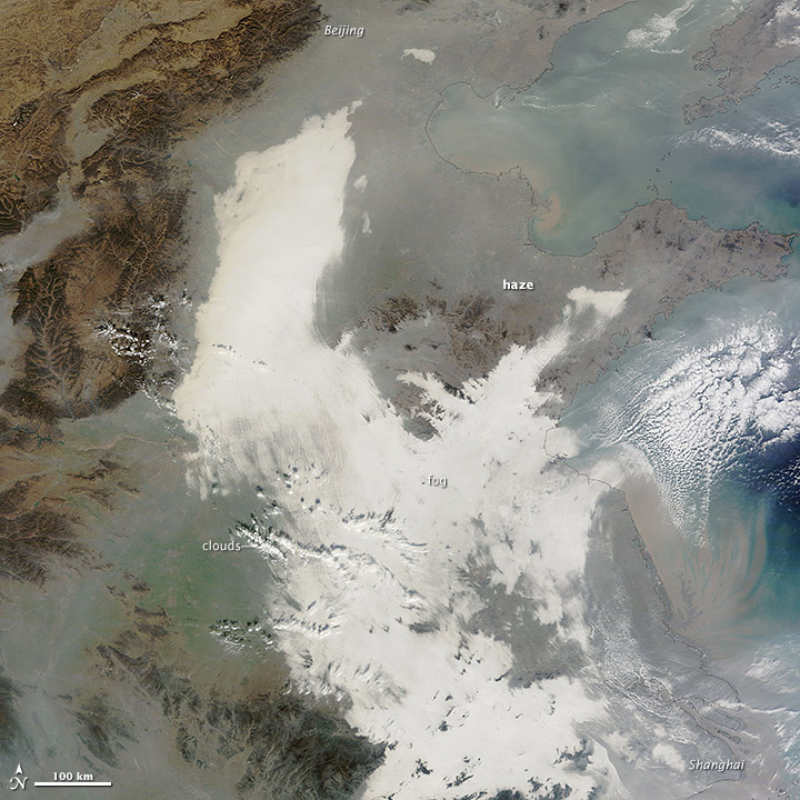
A layer of haze filled China’s Sichuan Basin on January 23, 2014, when the Moderate Resolution Imaging Spectroradiometer (MODIS) on NASA’s Terra satellite acquired this natural-color image. The haze obscured many features usually visible in satellite images of the area, including Sichuan province’s largest city, Chengdu. In the eastern part of the basin the tops of a series of ridges were visible above the layer of pollution. Skies were clear in the highlands west of the basin, while tendrils of pollution snaked into valleys northeast and southeast of it. Read more

NASA image courtesy Jeff Schmaltz, LANCE MODIS Rapid Response. Caption by Adam Voiland.

NASA image by Holli Riebeek and courtesy LANCE/EOSDIS MODIS Rapid Response Team at NASA GSFC. Caption by Michael Carlowicz.

A wildfire started and spread quickly in the foothills northeast of Los Angeles on January 16, 2014. The plume of ash and smoke blanketed much of the metropolitan area and prompted air quality warnings.

The Moderate Resolution Imaging Spectroradiometer (MODIS) on NASA’s Terra and Aqua satellites captured these images of the Colby fire just before (top) and just after noon on January 16. The morning image is clearer because the scene was centered under the satellite, while the afternoon image is fuzzy because the satellite was observing from an angle. Read more

NASA image by Holli Riebeek and courtesy LANCE/EOSDIS MODIS Rapid Response Team at NASA GSFC. Caption by Michael Carlowicz.

NASA Earth Observatory image courtesy Jeff Schmaltz LANCE/EOSDIS MODIS Rapid Response Team, GSFC. Caption by Adam Voiland.

In the midst of a cold snap that sent temperatures 20-40°F (11-22°C) below normal across much of the United States, the Moderate Resolution Imaging Spectroradiometer (MODIS) on the Terra satellite captured an image of cloud streets over the Atlantic Ocean on January 7, 2014. Read more

NASA Earth Observatory image courtesy Jeff Schmaltz LANCE/EOSDIS MODIS Rapid Response Team, GSFC. Caption by Adam Voiland.

NASA Earth Observatory images by Jesse Allen and Robert Simmon, using data from LANCE/EOSDIS Rapid Response. Caption by Adam Voiland.

On January 6, 2014, the Moderate Resolution Imaging Spectroradiometer MODIS on NASA’s Terra satellite captured this natural-color image (top) of fog forming over the lakes and streaming southeast with the wind.  A swirling mass of Arctic air moved south into the continental United States in early January 2014. On January 3, the air mass began breaking off from the polar vortex, a semi-permanent low-pressure system with a center around Canada’s Baffin Island. The frigid air was pushed south into the Great Lakes region by the jet stream, bringing abnormally cold temperatures to many parts of Canada and the central and eastern United States. Read more

NASA Earth Observatory images by Jesse Allen and Robert Simmon, using data from LANCE/EOSDIS Rapid Response. Caption by Adam Voiland.

Chinahaze_tmo_2013341

China suffered another severe bout of air pollution in December 2013. When the Moderate Resolution Imaging Spectroradiometer (MODIS) on NASA’s Terra satellite acquired this image on December 7, 2013, thick haze stretched from Beijing to Shanghai, a distance of about 1,200 kilometers (750 miles). For comparison, that is about the distance between Boston, Massachusetts, and Raleigh, North Carolina. The brightest areas are clouds or fog. Polluted air appears gray. While northeastern China often faces outbreaks of extreme smog, it is less common for pollution to spread so far south. Read more

NASA image courtesy Jeff Schmaltz, LANCE MODIS Rapid Response. Caption by Adam Voiland.