Image from TERRA
Tue, 18 Apr 2023 16:24 EDT

The Valley of Ten Thousand Smokes, located in Katmai National Park, forms a unique and ashen landscape. Encircled by volcanoes – both active and inactive – it has served as a perfect collection area for huge amounts of volcanic ash.

Image from TERRA
Tue, 20 Sep 2022 10:30 EDT

Water departments in the West are using maps and models originally created by a NASA team to help track water.

Image from TERRA
Thu, 15 Sep 2022 10:00 EDT

NASA and Google broadened an existing partnership to help local governments improve their monitoring and prediction of air quality for better decision making.

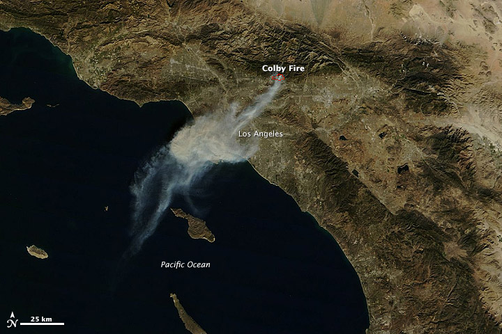
Colby Fire, California

NASA image by Holli Riebeek and courtesy LANCE/EOSDIS MODIS Rapid Response Team at NASA GSFC. Caption by Michael Carlowicz.

A wildfire started and spread quickly in the foothills northeast of Los Angeles on January 16, 2014. The plume of ash and smoke blanketed much of the metropolitan area and prompted air quality warnings.

The Moderate Resolution Imaging Spectroradiometer (MODIS) on NASA’s Terra and Aqua satellites captured these images of the Colby fire just before (top) and just after noon on January 16. The morning image is clearer because the scene was centered under the satellite, while the afternoon image is fuzzy because the satellite was observing from an angle. Read more

NASA image by Holli Riebeek and courtesy LANCE/EOSDIS MODIS Rapid Response Team at NASA GSFC. Caption by Michael Carlowicz.
Tagged with: ,