

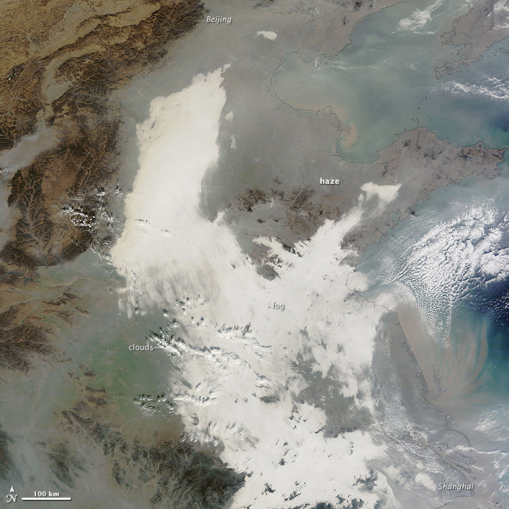
China suffered another severe bout of air pollution in December 2013. When the Moderate Resolution Imaging Spectroradiometer (MODIS) on NASA’s Terra satellite acquired this image on December 7, 2013, thick haze stretched from Beijing to Shanghai, a distance of about 1,200 kilometers (750 miles). For comparison, that is about the distance between Boston, Massachusetts, and Raleigh, North Carolina. The brightest areas are clouds or fog. Polluted air appears gray. While northeastern China often faces outbreaks of extreme smog, it is less common for pollution to spread so far south. Read more
NASA image courtesy Jeff Schmaltz, LANCE MODIS Rapid Response. Caption by Adam Voiland.