Image from TERRA
Tue, 20 Sep 2022 10:30 EDT

Water departments in the West are using maps and models originally created by a NASA team to help track water.

Image from TERRA
Thu, 15 Sep 2022 10:00 EDT

NASA and Google broadened an existing partnership to help local governments improve their monitoring and prediction of air quality for better decision making.

Image from TERRA
Mon, 11 Jul 2022 09:30 EDT

Ozone pollution assessments made for the Great Lakes region now include NASA satellite and other near-real time Earth observations.

Rare Middle Eastern Snow Seen by Terra

NASA image courtesy EOSDIS Worldview at NASA GSFC. Caption by Holli Riebeek.

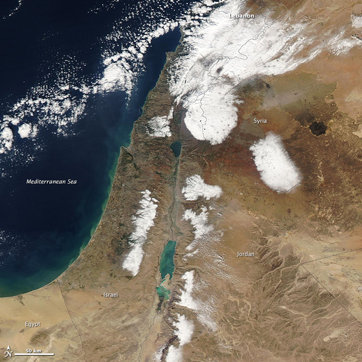
A rare winter storm dropped snow across much of the Middle East between December 10 and 13, 2013. The Moderate Resolution Imaging Spectroradiometer (MODIS) on NASA’s Terra satellite acquired this image of the snow on December 15 after the clouds cleared. For the most part, the snow is confined to higher elevations in Syrian, Egypt, Lebanon, Israel and West Bank, and Jordan. Some lower-elevation desert regions in Syria are snowy. Read more

NASA image courtesy EOSDIS Worldview at NASA GSFC. Caption by Holli Riebeek.
Tagged with: ,