Tag: ASTER

ASTER News and Events

sulaiman_ast_2011114_imbricate

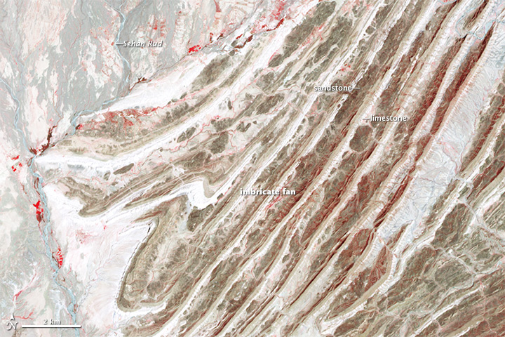
While not as high as the Himalayas or Karakoram, the Sulaiman range boast some of the most complex tectonic structures in the world. As India moved northward, it began to rotate in a counter-clockwise direction, wrenching the northwestern part of the Indian plate backwards into part of the Eurasian plate. The countervailing forces put the rocks of the Sulaiman range in a unique compressional vice, causing many of its faults to curve and stretch in convoluted ways.

The Advanced Spaceborne Thermal Emission and Reflection Radiometer (ASTER) instrument on NASA’s Terra satellite captured a scene on April 24, 2011, that highlights some of this tectonic complexity. Read more

NASA Earth Observatory image by Robert Simmon and Adam Voiland, with data courtesy of NASA/GSFC/METI/ERSDAC/JAROS, and the U.S./Japan ASTER Science Team. Caption by Adam Voiland.

pilger_ast_2014172

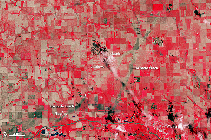
On June 16, 2014, a tornadic thunderstorm system moved across portions of northeast Nebraska, producing 5 tornadoes. Four of the tornadoes were rated as EF-4 on the Enhanced Fujita Scale, meaning that they were violent tornadoes with winds between 166 and 200 miles per hour. One EF-4 tornado spun directly through Pilger, Nebraska, a small town of 350 people, leveling much of the town.

The Advanced Spaceborne Thermal Emission and Reflection Radiometer (ASTER) instrument aboard NASA’s Terra satellite captured the top image of northeast Nebraska on June 21, 2014. Two of the EF-4 tornado tracks are visible in the false-color image (near-infrared, red, green). The tracks are tan paths of bare ground across plant-covered fields, which are red. The towns of Pilger and Wisner are bright white. The lower image, also from the ASTER instrument, shows the region on July 4, 2013. Turn on the comparison tool to contrast the before and after views. Read more

NASA Earth Observatory image by Jesse Allen, using data from NASA/GSFC/METI/ERSDAC/JAROS, and U.S./Japan ASTER Science Team. Caption by Kari Beckendorf and Holli Riebeek.

ubinas_ast_2014118

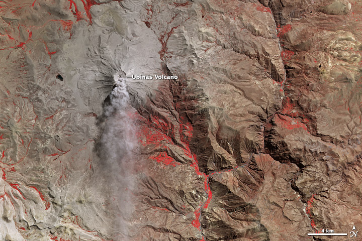
Despite a recent decline in earthquakes, Ubinas Volcano erupted another ash plume on April 28, 2014. The Advanced Spaceborne Thermal Emission and Reflection Radiometer (ASTER) collected this false-color view of the area on the same day. Red in the image indicates vegetation. Read more

NASA Earth Observatory image by Jesse Allen and Robert Simmon, using data from the NASA/GSFC/METI/ERSDAC/JAROS, and U.S./Japan ASTER Science Team. Caption by Robert Simmon.

NASA image by Robert Simmon with ASTER data. Caption by Holli Riebeek with information and review provided by David Mayer, Robert Simmon, and Michael Abrams.

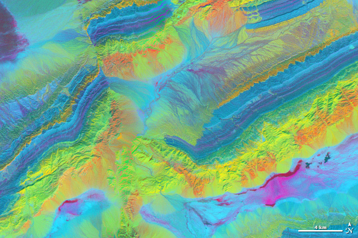
A satellite image is more than a photo. It is a picture of the amount and type of energy reflected or emitted by the Earth and recorded by a satellite instrument. There are many ways to combine those measurements to create an image, and each combination provides different insights.

The spectacular exposed geology of northwestern China offers an ideal landscape for illustrating how satellite measurements can identify minerals from afar. In satellite imagery, this area has three different sedimentary rock layers that are visible as rainbow stripes on a series of ridges. The Piqiang Fault has split the ridgeline, so the colored layers are offset by about three kilometers (two miles). All of the images on this page were made from data acquired on February 24, 2005, by the Advanced Spaceborne Thermal Emission and Reflection Radiometer (ASTER) on NASA’s Terra satellite. Read more

NASA image by Robert Simmon with ASTER data. Caption by Holli Riebeek with information and review provided by David Mayer, Robert Simmon, and Michael Abrams.

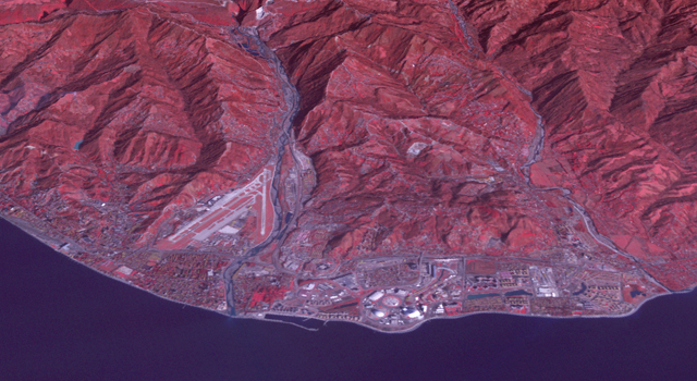
ASTER satellite image of the 2014 Sochi Winter Olympic Games Coastal Cluster, the site for arena sports and the opening and closing ceremonies. Image credit: NASA/GSFC/METI/ERSDAC/JAROS, and U.S./Japan ASTER Science Team

If Satellites won gold metals, Terra may win for most striking view of the 2014 Winter Olympics in Sochi Russia. Using the Advanced Spaceborne Thermal Emissions and Reflection Radiometer (ASTER) the mountains of the Rosa Khutar ski resort near Sochi, Russia. Snow is shown as white, while vegetation is red and buildings are gray. At the bottom of the image the Black Sea appears black. read more from JPL news

ASTER satellite image of the 2014 Sochi Winter Olympic Games Coastal Cluster, the site for arena sports and the opening and closing ceremonies. Image credit: NASA/GSFC/METI/ERSDAC/JAROS, and U.S./Japan ASTER Science Team

Or see what these other news sources had to say:
Washington Post

Science World Report

Guardian

Space Coast Daily

Wall Street Journal