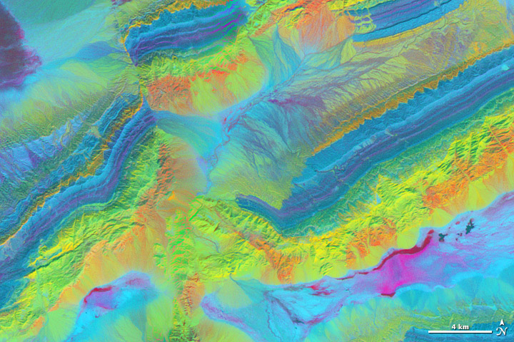
A satellite image is more than a photo. It is a picture of the amount and type of energy reflected or emitted by the Earth and recorded by a satellite instrument. There are many ways to combine those measurements to create an image, and each combination provides different insights.
The spectacular exposed geology of northwestern China offers an ideal landscape for illustrating how satellite measurements can identify minerals from afar. In satellite imagery, this area has three different sedimentary rock layers that are visible as rainbow stripes on a series of ridges. The Piqiang Fault has split the ridgeline, so the colored layers are offset by about three kilometers (two miles). All of the images on this page were made from data acquired on February 24, 2005, by the Advanced Spaceborne Thermal Emission and Reflection Radiometer (ASTER) on NASA’s Terra satellite. Read more
- NASA image by Robert Simmon with ASTER data. Caption by Holli Riebeek with information and review provided by David Mayer, Robert Simmon, and Michael Abrams.


