

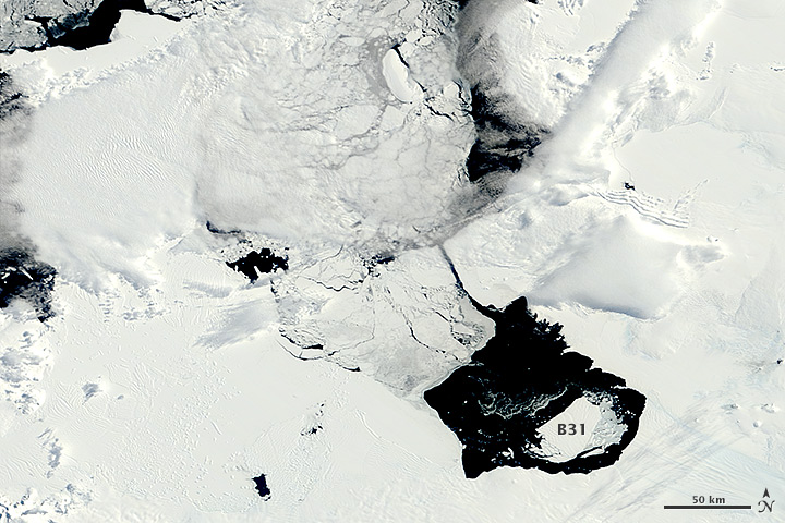
In early November 2013, a large iceberg separated from the front of Antarctica’s Pine Island Glacier. It thus began a journey across Pine Island Bay, a basin of the Amundsen Sea. The ice island, named B31, will likely be swept up soon in the swift currents of the Southern Ocean, though it will be hard to track visually for the next six months as Antarctica heads into winter darkness.
Over the course of five months in Antarctic spring and summer, the Moderate Resolution Imaging Spectroradiometer (MODIS)—an instrument on NASA’s Terra and Aqua satellites—captured a series of images of ice island B31. Read more
- NASA images by Jeff Schmaltz, LANCE/EOSDIS Rapid Response. Caption by Michael Carlowicz.