

The satellites in NASA’s Earth Observing System collect data and imagery for scientific research. The data goes to one of twelve Distributed Active Archive Centers (DAACs) across the United States, where it is processed and distributed to scientists who mine it for clues about our environment.
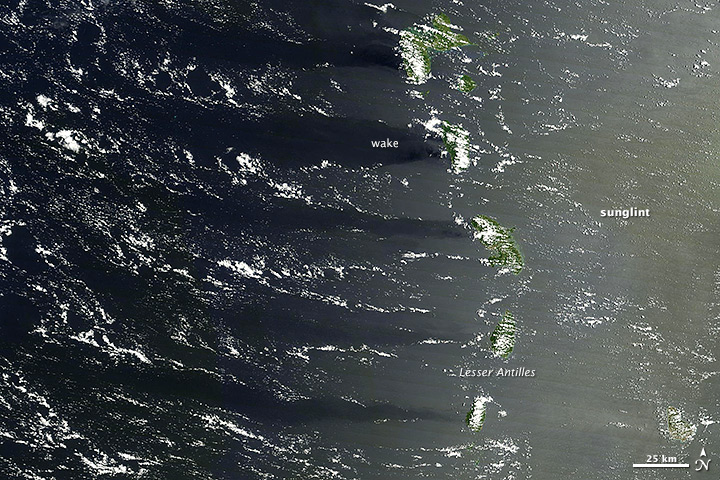
But sometimes the imagery is remarkable simply for its beauty. When the Moderate Resolution Imaging Spectroradiometer (MODIS) on NASA’s Terra satellite looked down on the Lesser Antilles on August 1, 2013, the combination of sunlight, islands, and wind painted this scene on the surface of the Caribbean Sea. The right side of the image has a milky hue because of sunglint, an optical effect caused by the mirror-like reflection of sunlight off the water surface directly back at the satellite sensor. Read more
- NASA image courtesy LANCE/EOSDIS MODIS Rapid Response Team, GSFC. Caption by Adam Voiland and Michael Carlowicz.