Year: 2015

wolf_ast_2015162

NASA Earth Observatory image by Jesse Allen, using data from NASA/GSFC/METI/ERSDAC/JAROS, and U.S./Japan ASTER Science Team. Caption by Mike Carlowicz.

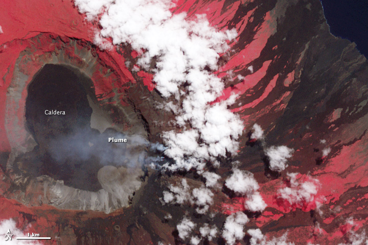
In late May 2015, the highest volcano in the Galapagos Islands erupted for the first time in 33 years. The explosive eruption at Wolf volcano on Isabela Island sent volcanic gases and ash roughly 15 kilometers (50,000 feet) into the sky, while lava flowed through a fissure, down eastern and southeastern slopes, and eventually reached the sea. In early June, the sulfur-rich lava flows on the slopes appeared to subside.

The wide image and closeup of Wolf was acquired on June 11, 2015, by the Advanced Spaceborne Thermal Emission and Reflection Radiometer (ASTER) on the Terra satellite. The false-color images combine near-infrared, red, and green light (ASTER bands 3-2-1), with vegetated areas appearing in red and lava generally appearing charcoal or black. Note, however, the infrared (IR) image on the top right, where the heat signature of the freshly placed lava appears as white streaks. (The image is smaller because the sensor has lower resolution.) Read more

shasta_ast_2014245

NASA Earth Observatory images by Joshua Stevens, using data from NASA/GSFC/METI/ERSDAC/JAROS, and U.S./Japan ASTER Science Team. Caption by Kathryn Hansen.

The ongoing drought in the western United States is evident in the water levels of Shasta Lake, a large reservoir in northern California that counts on rainfall for replenishment. Low water levels can lead to hazardous conditions for local recreation. Many more people are affected by how this limited water resource is allocated for ecological, urban, and agricultural needs downstream.

The Advanced Spaceborne Thermal Emission and Reflection Radiometer (ASTER) on Terra acquired these simulated true-color images of Shasta Lake. The top image shows the lake on September 14, 2005, and the bottom image was acquired on September 2, 2014. Read more

icebergb34_amo_2015064

NASA images by Jeff Schmaltz, LANCE/EOSDIS Rapid Response. Caption by Kathryn Hansen.

On March 6, 2015, the U.S. National Ice Center (NIC) discovered a new iceberg adrift off the coast of Antarctica. Measuring 27 kilometers (17 miles) long, iceberg B-34 meets the 19-kilometer minimum required for tracking by the NIC.

The berg appears to have fractured from West Antarctica’s Getz Ice Shelf and moved out into in the Amundsen Sea sometime in mid- to late-February 2015. The Moderate Resolution Imaging Spectroradiometer (MODIS) on NASA’s Terra and Aqua satellites acquired these images spanning the calving event. The first image (left) shows the iceberg on February 16, when it was still attached to the ice shelf. By February 28 (middle), it appears to have separated somewhat. By March 5 (right), it is floating freely. Read more

NASA Earth Observatory image (top) by Joshua Stevens using Landsat data from the U.S. Geological Survey and ASTER GDEM2 data from NASA/MITI and the ASTER Science Team.

NASA Earth Observatory image (top) by Joshua Stevens using Landsat data from the U.S. Geological Survey and ASTER GDEM2 data from NASA/MITI and the ASTER Science Team.

At approximately 6:45 a.m. on April 18, 2014, a block of ice tumbled from the edge of a hanging glacier onto a popular climbing route on the south face of Mount Everest. The ice, which weighed as much as 657 passenger buses, tumbled about 400 meters (1,300 feet) and triggered an avalanche. The falling ice and rock overwhelmed a group of Nepalese guides who were ferrying equipment from Base Camp (elevation 5,270 meters) to Camp 1 (elevation 6,035 meters) for foreign clients. Sixteen guides died in the avalanche, making it Everest’s deadliest day.

This three-dimensional rendering—made with data collected by the Operational Land Imager on Landsat 8 and the Advanced Spaceborne Thermal Emission and Reflection Radiometer (ASTER) on Terra—offers a broad view of the topography that climbers face. Read More

NASA image by Jeff Schmaltz, LANCE/EOSDIS Rapid Response. Caption by Kathryn Hansen.

NASA image by Jeff Schmaltz, LANCE/EOSDIS Rapid Response. Caption by Kathryn Hansen.

Spring and summer are the prime seasons for dust storms in China’s Taklimakan Desert. On April 1, 2015, the Moderate Resolution Imaging Spectroradiometer (MODIS) on NASA’s Terra satellite captured this natural-color image of dust from the desert and from the greater Tarim Basin.

The Tarim is bordered by the Tian Shan mountains to the north (obscured by clouds in this image) and the Kunlun Shan mountains to the south. The basin opens up on its east side, but that’s not necessarily an escape route for dust. The prevailing low-altitude winds come from the east, keeping most dust below 5 kilometers—about the height of the mountain ranges—and confined to the desert. Read more