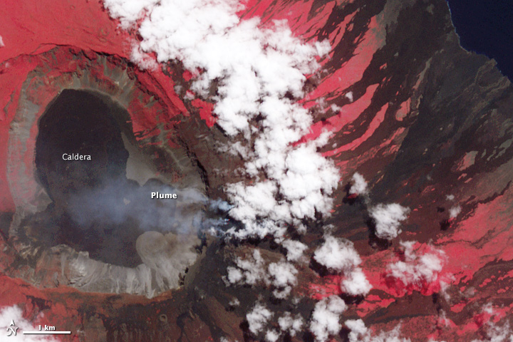
NASA Earth Observatory image by Jesse Allen, using data from NASA/GSFC/METI/ERSDAC/JAROS, and U.S./Japan ASTER Science Team. Caption by Mike Carlowicz.
In late May 2015, the highest volcano in the Galapagos Islands erupted for the first time in 33 years. The explosive eruption at Wolf volcano on Isabela Island sent volcanic gases and ash roughly 15 kilometers (50,000 feet) into the sky, while lava flowed through a fissure, down eastern and southeastern slopes, and eventually reached the sea. In early June, the sulfur-rich lava flows on the slopes appeared to subside.
The wide image and closeup of Wolf was acquired on June 11, 2015, by the Advanced Spaceborne Thermal Emission and Reflection Radiometer (ASTER) on the Terra satellite. The false-color images combine near-infrared, red, and green light (ASTER bands 3-2-1), with vegetated areas appearing in red and lava generally appearing charcoal or black. Note, however, the infrared (IR) image on the top right, where the heat signature of the freshly placed lava appears as white streaks. (The image is smaller because the sensor has lower resolution.) Read more

