

NASA image courtesy Jeff Schmaltz, LANCE/EOSDIS MODIS Rapid Response Team at NASA GSFC. Caption and image cropping by Adam Voiland.
The 2015 fire season got off to an unusually early start in Canada when blazes broke out in the Northwest Territories, British Columbia, and Alberta in late May. As the season has progressed, the air in western Canada—as well as large swaths of the United States—grew gray and hazy with smoke.
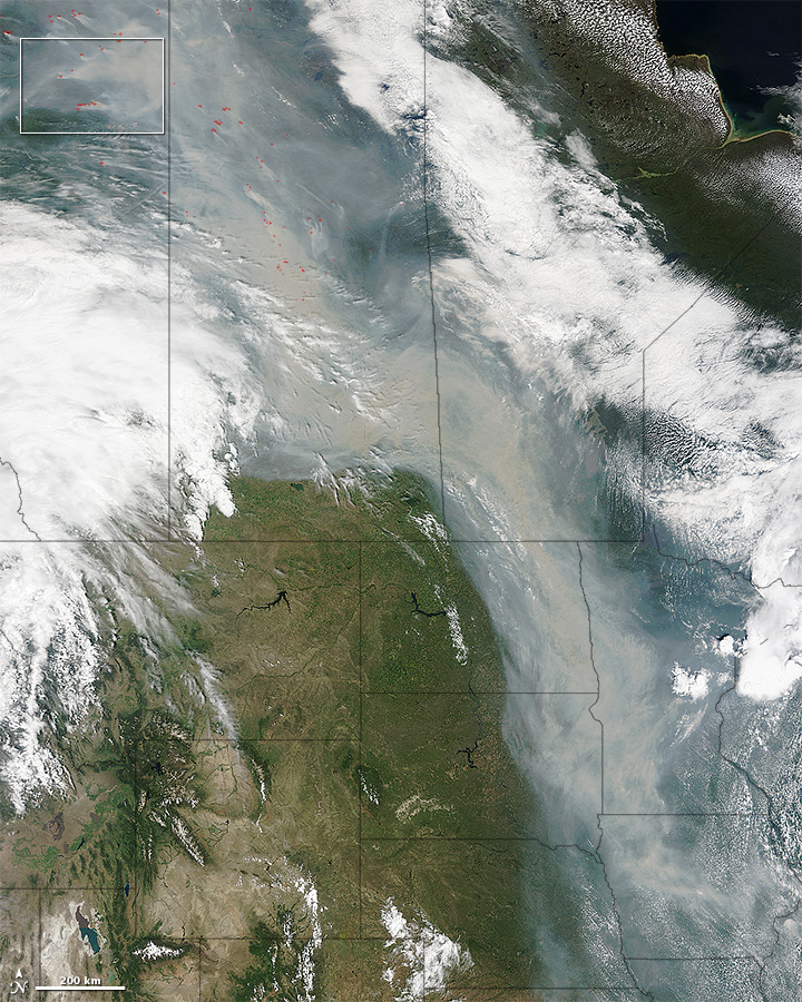
Beginning on June 28, a sharp trough in the jet stream sent a river of smoke streaming south into the United States. By June 29, smoke darkened the skies over much of Saskatchewan, Alberta, Manitoba, North Dakota, South Dakota, Minnesota, and Iowa.
On June 29, 2015, the Moderate Resolution Imaging Spectroradiometer (MODIS) on NASA’s Terra satellite captured this image of smoke from hundreds of wildfires in western Canada. Read more