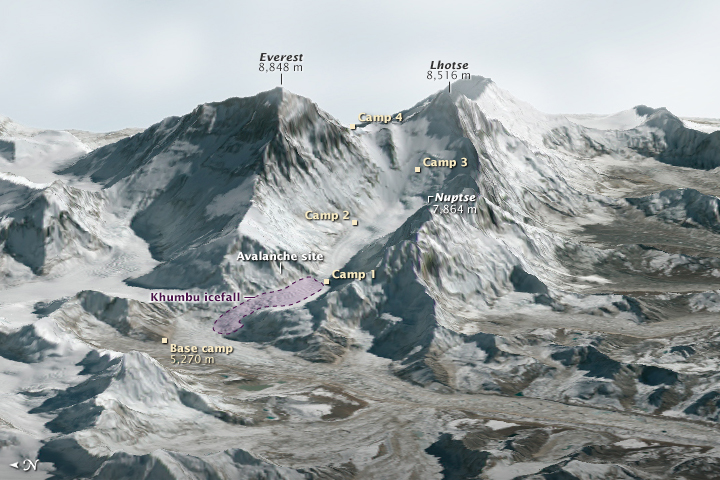
NASA Earth Observatory image (top) by Joshua Stevens using Landsat data from the U.S. Geological Survey and ASTER GDEM2 data from NASA/MITI and the ASTER Science Team.
At approximately 6:45 a.m. on April 18, 2014, a block of ice tumbled from the edge of a hanging glacier onto a popular climbing route on the south face of Mount Everest. The ice, which weighed as much as 657 passenger buses, tumbled about 400 meters (1,300 feet) and triggered an avalanche. The falling ice and rock overwhelmed a group of Nepalese guides who were ferrying equipment from Base Camp (elevation 5,270 meters) to Camp 1 (elevation 6,035 meters) for foreign clients. Sixteen guides died in the avalanche, making it Everest’s deadliest day.
This three-dimensional rendering—made with data collected by the Operational Land Imager on Landsat 8 and the Advanced Spaceborne Thermal Emission and Reflection Radiometer (ASTER) on Terra—offers a broad view of the topography that climbers face. Read More

