After nearly 25 years of observing Earth’s lower atmosphere, tracking harmful emissions from wildfires and industrial sources, the Canadian Measurement of Pollution in the Troposphere (MOPITT) instrument on NASA’s Terra satellite was turned off, on April 9, to conserve the satellite’s remaining power. Terra, which carries five instruments, launched in December 1999 on a six-year mission designed to study the planet’s land, ocean, atmosphere and biosphere simultaneously as the flagship mission of NASA’s Earth Observing system. Terra is a partnership between the United States, Canada and Japan. The CSA (Canadian Space Agency) contributed the MOPITT instrument to the Terra satellite.
Last month, more than 45 scientists gathered to discuss findings from MOPITT’s quarter-century record of atmospheric carbon monoxide. Its data showed a global decline in carbon monoxide emissions over two decades and could also track the atmospheric transport of the gas from fires and industry from individual regions. MOPITT is a testament to remarkable international collaboration and achievement. As it is officially decommissioned, its data record will continue to drive research for years to come.
In addition, NASA has turned power back on to Terra’s Advanced Spaceborne Thermal Emission and Reflection (ASTER) Japanese instrument. Japan’s Ministry of Economy, Trade and Industry contributed ASTER.
By Kate Ramsayer, NASA’s Goddard Space Flight Center
Over the past three years, the Terra mission has performed multiple maneuvers that have led to changes in the satellite’s consistent 20+ year orbit*. Today, Terra continues slowly drifting to an increasingly earlier overpass time and lower altitude. While the orbital changes have had little to no impact on instrument data collection or quality, data users have expressed the need for regular updates on Terra’s equator crossing time (in Mean Local Time), as well as orbital altitude. Starting this month, we’ll be adding this information to the Terra homepage and updating it bi-weekly using data provided by the Flight Dynamics Team.
Finally, processing of ASTER data has re-started, with updated Level-1processing to account for the lower Terra orbit. Processing of the previously-collected data since late October 2022 to the end of June 2023 is also taking place. See the infographic provided on the Terra website for more information, and for the latest news on all things related to Terra data, visit the Alerts and Issues page available on the LAADS DAAC website (linked here).
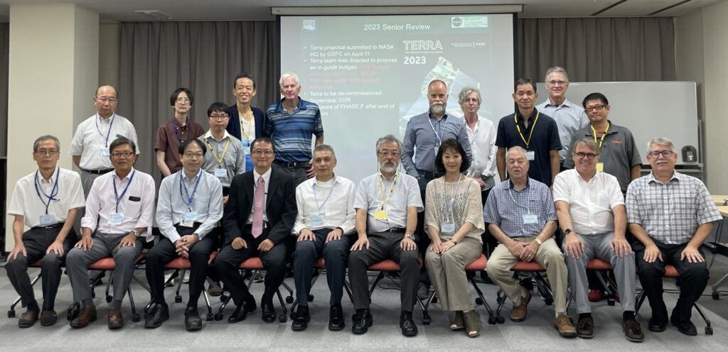
Here’s a list of 2023 happenings and publications for each Terra instrument:
ASTER:
The 52nd ASTER Science & Interface Meeting was held at the Kikai Shinko Kaikan in Minato-ku, Tokyo, Japan from September 11-15, 2023 (group photo posted below). The meeting included two Plenary sessions, as well as presentations from ASTER working groups, including Operations and Mission Planning (OMP), Applications, Calibration and Validation, Temperature-Emissivity Separation (TES), and the Science Team Acquisition Request (STAR) groups. Meeting presentations showcased diverse applications of ASTER data in various fields and activities, including mineral and other geologic mapping projects, coastal monitoring activities, cryospheric studies, machine learning models for urban land dynamics, and volcanic eruption precursor detection. Additionally, updates were provided on the ASTER Volcano Archive and the Global Land Ice Measurements from Space (GLIMS) Database. A copy of meeting presentations are available upon request.
Photo credit: Mako Komoda, Japan Space Systems
CERES:
The next CERES meeting will be held in-person from October 17-19, 2023 at NASA Goddard Institute for Space Studies, in New York City, NY. See the “Meeting Logistics and Recommended Hotels” link on the CERES website for more information about attending the meeting and a link to the full agenda (also linked here). Many exciting speakers are scheduled to speak at the meeting, so check back to the Terra website often for an update and summary after the meeting!
MISR:
The MISR team has been working hard on algorithm adjustments needed to finalize the Level-1 data processing take into account the effects of Terra’s orbit lowering in October 2022. Additional updates on the status of this process will be posted on the Terra website, including a notice when processing has begun.
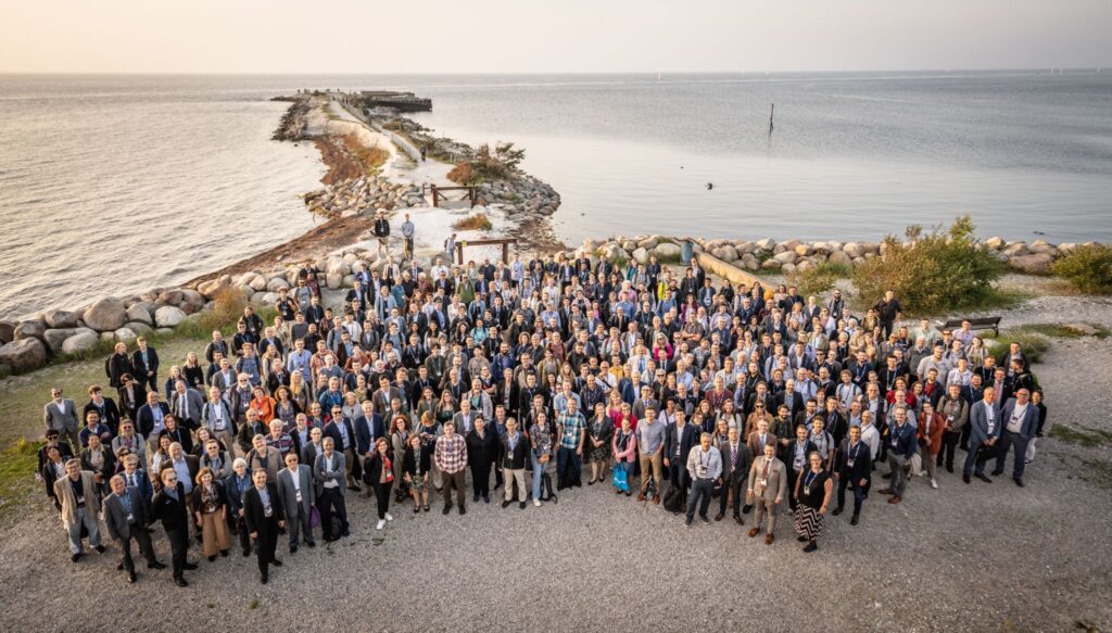
Miguel Román (MODIS) and Helen Wooden (MOPITT) both attended the European Organisation for the Exploitation of Meteorological Satellites (EUMETSAT) Meteorological Satellite Conference 2023 that took place in Malmö, Sweden, from September 11-15, 2023. A (beautiful) group photo from the meeting is included below.
Miguel Román participated in several sessions to discuss EUMETSAT’s plans for morning-orbit polar orbiting observations. As recommended by NASA’s Terra, Aqua, and Aura Data Continuity Workshop, the EUMESAT Multispectral Visible Infrared Imager (METImage) on the Metop-SG A satellite, due to launch in December 2024, is being explored as a possible source of morning data product continuity, currently represented by the suite of standard science products generated from the MODIS instrument onboard Terra.
Helen Worden presented trends using the MOPITT data record of global carbon monoxide (CO) and plans for continuation of the MOPITT record using MetOP/IASI, NOAA/CrIS and ESA/TROPOMI data. The MOPITT team has long collaborated with the EUMETSAT IASI instrument team on satellite data inter-comparisons. Comparisons with MOPITT data have been especially important for new instruments in space, since MOPITT has the longest available record of satellite CO observations. The EUMETSAT meeting had many useful presentations on atmospheric composition and trends, among other interesting topics, with plenty of networking opportunities for developing new ideas for research and plans for data continuity.
We recently featured several important scientists who use Terra data in their research, including Dr. Rebecca Buchholz (check out the post here) who works with Dr. Helen Worden, the US Principal Investigator for the Measurements of Pollution in the Troposphere (MOPITT) sensor to evaluate spatial patterns of air pollution critical for natural hazard response and public health planning.
MOPITT data are used to derive carbon monoxide concentrations such as those released from burning vegetation, coal, and other combustible plant material. MOPITT carbon monoxide measurements are used to determine where wildfires are burning and to infer the presence of other air pollutants, too. After analyzing over 15 years of data, the MOPITT team found that overall carbon monoxide levels have decreased globally over the past decade, but with varying amounts related to regional land use differences. Additionally, the team also discovered that an increase in new seasonal peaks of air pollution– especially from summer wildfires burning in the American Pacific Northwest – contribute to increased health risks “downwind” of these fires – even impacting places as far away as Colorado! Find out more about this research in this NCAR/UCAR News article and this Earth Observatory Image of the Day!
With Terra’s 25th Anniversary only two years away (December 2024), we’re kicking off the celebration early in our News and Events section with a new series highlighting some of Terra’s researchers, data users, educators, and science communicators. We’re especially excited to promote current and proposed research that uses Terra data in unique or novel ways! (Do you know someone who’s made important contributions to the Terra mission? Or a groundbreaking Terra study that you feel made a substantial impact in the fields of earth science or remote sensing? We’d love to feature them – email us your ideas!)
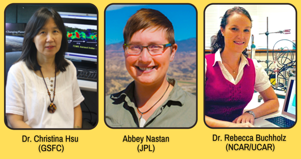
Our first post in this series highlights three trailblazing women at NASA who have contributed to Terra’s scientific legacy, while showcasing the collaborative efforts among scientists at Goddard, JPL, and NCAR/UCAR. Check out their stories below!
Dr. Nai-Yung Christina Hsu (GSFC)
Dr. Christina Hsu, a researcher from GSFC, has incorporated data from many of Terra’s instruments into her research. Most notably, in 2004, she developed a Deep Blue algorithm for MODIS data that better characterizes aerosol properties over deserts and urban areas. (Read the groundbreaking article here!)
More recently, Dr. Hsu collaborated with a team studying regional differences in air pollution reductions, due to the global COVID-19 lockdowns of 2020. She used datasets from MODIS and MISR (two instruments on Terra) to analyze aerosol optical depth (click the link to learn more!). Learn more about Dr. Hsu’s research using this link, and access the full article here!
Abigail (Abbey) Nastan (JPL)
Check out this recent Earthdata feature of our own MISR instrument Applications and Communications lead, Abbey Nastan! This summary gives an overview of the diverse portfolio of projects that Abbey is currently working on, including MERLIN – a unique visualization tool that leverages the MISR Plume Height Project dataset, giving new life to “old-er” data.
Meet Dr. Rebecca Buchholz, a MOPITT Project Scientist who has worked at NCAR/UCAR since 2014 and has used MOPITT’s carbon monoxide dataset to study long-term patterns of air pollution transportation, especially that associated with wildfires. In a Scientific American news article last month, Dr. Buchholz summarized her recent research findings (published in Nature Communications) that show a significant increase in Western U.S. wildfire air pollution during the month of August, a new peak that largely negates California’s efforts to reduce annual air pollution. (She also gave Terra’s long data-record a shout-out!) Read more about her research here!
To return function to 16 printed wire assemblies, including the two most recent, Terra’s Flight Operations Team rebooted Terra’s solid state recorder, on September 22, 2021. The successful reboot of Terra’s solid state recorder returned Terra to a level that allows full science acquisitions from all five instruments (ASTER, CERES, MISR, MODIS, and MOPITT).
The recorder reboot took nearly 12 hours to complete. The board-by-board power up sequencing resulted in all 16 printed wire assemblies of the 16 offline assemblies returning to operational status. Terra now has all 58 assemblies in service, and Terra’s data storage capacity is at the same level it had at launch. There are currently no known hardware limitations to the operation of Terra or any of its sensors and there is currently no official passivation (mission end) date.
For over two decades Terra has collected valuable data about Earth’s systems. In February 2020 Terra stopped doing platform maneuvers that would control its equator crossing time in order to maintain fuel for collision avoidance maneuvers. The remaining fuel will also be used to lower Terra’s orbit as part of its eventual passivation process. Now with the printed wire assemblies being returned to full function, Terra will be able to collect full data acquisitions from all five instruments throughout this process.
Terra will also continue collecting data after an orbit lowering maneuver planned for Fall 2022. The maneuver upholds agreements to ensure Terra is a safe distance from the other missions in the 705-km Earth Observing Satellite Constellation when fuel to maintain Terra’s orbit has been depleted.
“The science community views the changes in crossing time and orbit altitude as continuation of normal data collection for those products not affected by the orbital changes as well as an opportunity to do novel science with those that are affected,” according to Kurtis Thome, Terra Project Scientist. The Terra Project fully expects the Terra platform and all five instruments to operate past 2026 allowing them to maintain their status as leaders in Earth science data production. Terra’s long-term data record will continue to contribute to the Earth Science Division’s key science questions:
How is the global Earth system changing?
What causes these changes in the Earth system?
How will the Earth system change in the future?
How can Earth system science provide societal benefit?
Terra, the flagship Earth Observing Satellite, continues to be a leader in Earth science data, contributing to scientific research and applications worldwide, now with data capacity levels restored by a successful solid state recorder reboot.