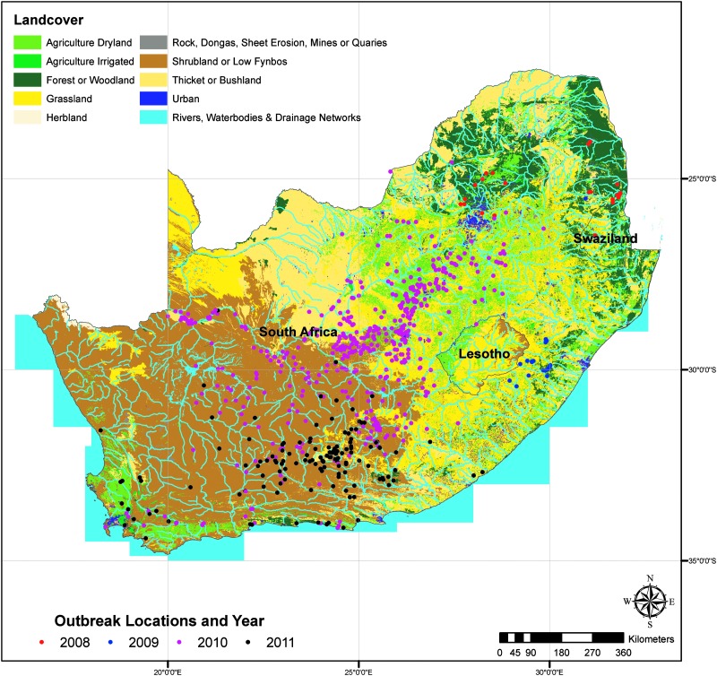
Reported Rift Valley fever (RVF) case locations in relation to Land Use/Land Cover. Image courtesy of: Margaret M. Glancey, et al., 2015; Published by Mary Ann Liebert, Inc.
Moderate Imaging Spectroradiometer (MODIS) data in the Normalized Difference Vegetation Index (NDVI), an index that shows plants “greenness” or photosynthetic activity, is helping better understand risk factors associated with Rift Valley Fever outbreaks in Southern Africa.
A recent study published in the National Center for Biotechnology Information’s Pub Med looked at epidemiological and environmental risk factors from 2008 – 2011, the worst outbreak of Rift Valley fever in almost 40 years.
Periods of widespread and above-normal rainfall are associated with Rift Valley Fever outbreaks. Researchers combined data from the World Animal Health Information Database (WAHID) on what types of species were affected, where and when with environmental factors including rainfall and NDVI.
The results of the study show that these environmental factors along with geographic factors (topography, drainage, and land use) do play a role in the emergence of Rift Valley Fever.
This study will help the accuracy of future models of areas at risk, allowing more time to adequately prepare and prevent future outbreaks.
Read the full article at http://www.ncbi.nlm.nih.gov/pubmed/26273812


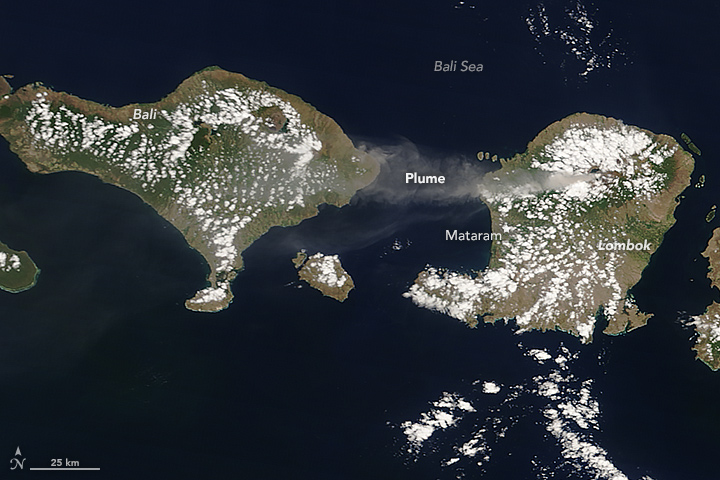 An image from the Moderate Imaging Spectroradiometer (MODIS) on NASA’s Terra satellite captured the eruption of Mount Rinjani in Indonesia, blanketing ash across three Indonesian Islands. The plume was 3.5 kilometers (11,500 feet) above sea level and moved westward, affecting air travel in early November. The image was featured on NASA’s Earth Observatory.