7 November, 2015
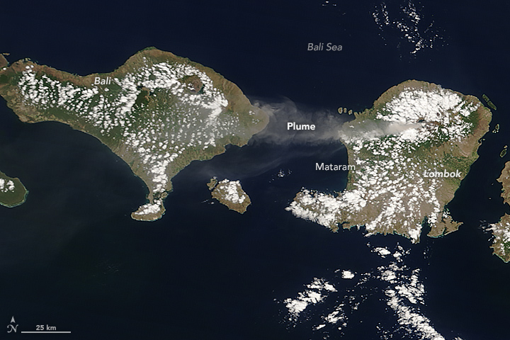
 An image from the Moderate Imaging Spectroradiometer (MODIS) on NASA’s Terra satellite captured the eruption of Mount Rinjani in Indonesia, blanketing ash across three Indonesian Islands. The plume was 3.5 kilometers (11,500 feet) above sea level and moved westward, affecting air travel in early November. The image was featured on NASA’s Earth Observatory.

