Tag: Atmosphere

Atmosphere News and Events

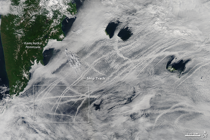
PacificOcean_amo_2015208 A scientist, Yi-Chun (Jean) Chen, at NASA’s Jet Propulsion Laboratory, and his colleagues were able to show how open-cell versus closed cell clouds affect the brightness, or albedo, of ship tracks.

Using data from MODIS on-board both Aqua and Terra and from the Multi-angle Imaging SpectroRadiometer (MISR) on Terra, the team studied the relationship between ship-emitted aerosols and cloud properties. The results suggested that aerosol plumes increased the amount of clouds and albedo in open-cell formation areas; where as, areas with closed-cells were less susceptible to aerosol plumes.

Research available in the April 2015 Journal of Geophysical Research

Read more on NASA’s Earth Observatory


cirrus_cat_2015092

NASA Earth Observatory image by Jesse Allen, using data provided by John Yorks and Matthew McGill of the Cloud-Aerosol Transport System (CATS) team. Caption by Kathryn Hansen.

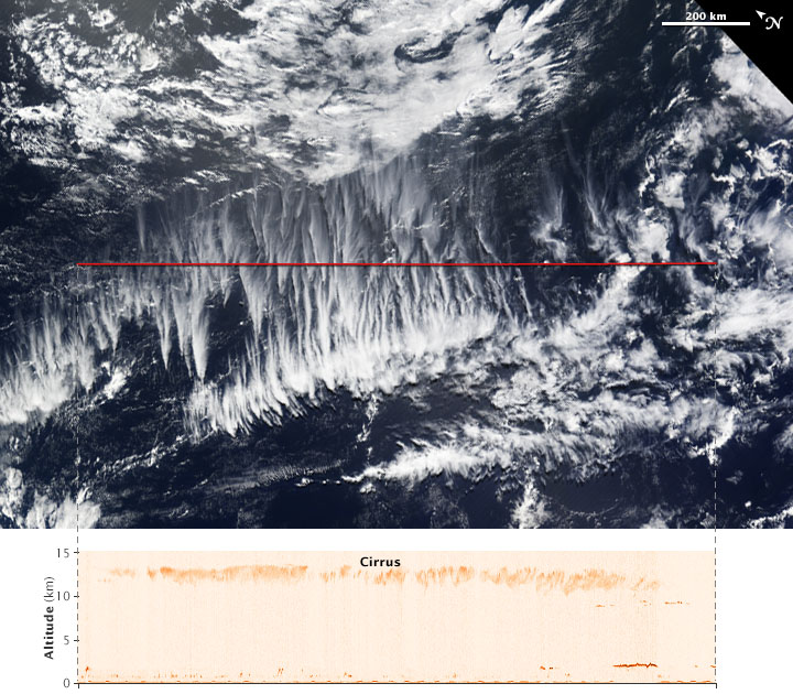
Cirrus—the wispy, icy clouds that form high in the atmosphere—are known to have a net warming effect on the climate. But how much? The question is hard to answer because even among cirrus clouds, there is wide variety and complexity in their structure.

The Moderate Resolution Imaging Spectroradiometer (MODIS) on NASA’s Terra satellite acquired a natural-color view of clouds over the South Pacific on April 2, 2015. Cirrus are the thinner clouds appearing to spread out from points across the center of the image.

The red line on the MODIS image shows the area scanned just hours before by the Cloud-Aerosol Transport System (CATS) onboard the International Space Station. “The space station orbit provides comprehensive coverage of the tropical and mid-latitude regions, where cirrus clouds are most prevalent,” said John Yorks, science lead of the CATS team at NASA’s Goddard Space Flight Center. Read more

britishcolumbia_tmo_2015186

NASA images by Jeff Schmaltz, LANCE/EOSDIS Rapid Response. Caption by Mike Carlowicz.

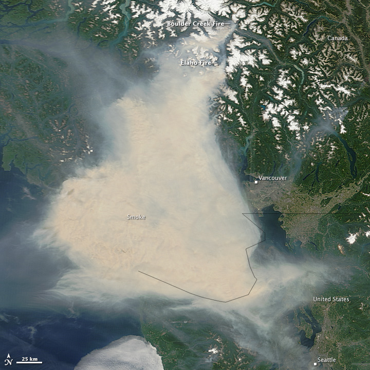
A difficult fire season in western Canada brought its impacts to coastal city streets in early July 2015. A thick pall of smoke settled over Vancouver and adjacent areas of British Columbia, leading some residents to wear face masks and health officials to warn residents and World Cup tourists against outdoor activities.

The Moderate Resolution Imaging Spectroradiometer (MODIS) on NASA’s Terra satellite acquired these images in the late morning on July 5 and 6. Note how the tan and gray smoke almost completely obscures the Strait of Georgia and southern Vancouver Island. Winds shifted abruptly between July 5 and 6, driving the smoke plume toward the east, dispersing it in some places while fouling the air in areas to the east, such as the Fraser Valley. Read more

NASA image by Jeff Schmaltz, LANCE/EOSDIS Rapid Response. Caption by Kathryn Hansen.

NASA image by Jeff Schmaltz, LANCE/EOSDIS Rapid Response. Caption by Kathryn Hansen.

Spring and summer are the prime seasons for dust storms in China’s Taklimakan Desert. On April 1, 2015, the Moderate Resolution Imaging Spectroradiometer (MODIS) on NASA’s Terra satellite captured this natural-color image of dust from the desert and from the greater Tarim Basin.

The Tarim is bordered by the Tian Shan mountains to the north (obscured by clouds in this image) and the Kunlun Shan mountains to the south. The basin opens up on its east side, but that’s not necessarily an escape route for dust. The prevailing low-altitude winds come from the east, keeping most dust below 5 kilometers—about the height of the mountain ranges—and confined to the desert. Read more

china_tmo_2013357

NASA image courtesy Jeff Schmaltz, LANCE/EOSDIS MODIS Rapid Response Team at NASA GSFC. Caption by Adam Voiland.

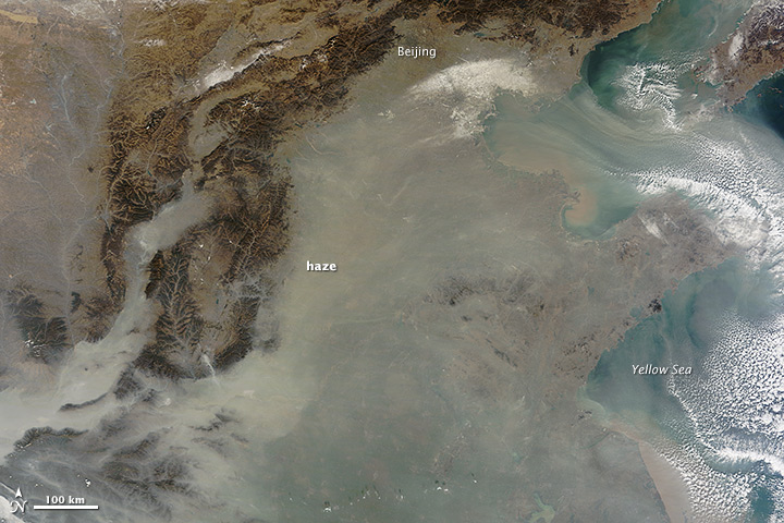
The natural-color satellite image below offers both a modern and historical context. Captured by the Moderate Resolution Imaging Spectroradiometer (MODIS) on NASA’s Terra satellite, it shows heavy pollution heading toward Beijing, China, on December 12, 2013. If satellites had been flying in the first half of the 20th century, it’s reasonable to assume that skies over the eastern United States or Europe would have looked something like this on some days. Read more