Image from TERRA
Tue, 18 Apr 2023 16:24 EDT

The Valley of Ten Thousand Smokes, located in Katmai National Park, forms a unique and ashen landscape. Encircled by volcanoes – both active and inactive – it has served as a perfect collection area for huge amounts of volcanic ash.

Image from TERRA
Tue, 20 Sep 2022 10:30 EDT

Water departments in the West are using maps and models originally created by a NASA team to help track water.

Image from TERRA
Thu, 15 Sep 2022 10:00 EDT

NASA and Google broadened an existing partnership to help local governments improve their monitoring and prediction of air quality for better decision making.

Smoke Blankets British Columbia

britishcolumbia_tmo_2015186

NASA images by Jeff Schmaltz, LANCE/EOSDIS Rapid Response. Caption by Mike Carlowicz.

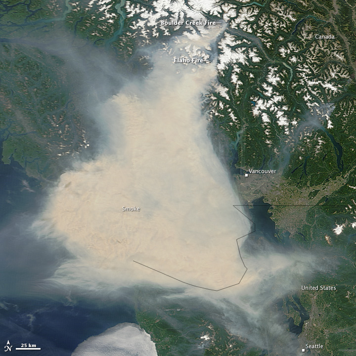
A difficult fire season in western Canada brought its impacts to coastal city streets in early July 2015. A thick pall of smoke settled over Vancouver and adjacent areas of British Columbia, leading some residents to wear face masks and health officials to warn residents and World Cup tourists against outdoor activities.

The Moderate Resolution Imaging Spectroradiometer (MODIS) on NASA’s Terra satellite acquired these images in the late morning on July 5 and 6. Note how the tan and gray smoke almost completely obscures the Strait of Georgia and southern Vancouver Island. Winds shifted abruptly between July 5 and 6, driving the smoke plume toward the east, dispersing it in some places while fouling the air in areas to the east, such as the Fraser Valley. Read more

Tagged with: ,