Tag: ASTER

ASTER News and Events

The American Geophysical Union recently concluded its Fall meeting in San Fransisco, California from December 14 – 18, 2015.  As part of the meeting contributions to science were featured on NASA.gov.  Data from Terra’s instruments played important roles in collecting data to further research in each of these featured areas.  Read the full features from NASA.gov available at the links below.

El Niño

NASA: Observing the 2015 El Niño – The strongest El Niño since 1997 – 1998 is being monitored for the first time by a host of satellites, including Terra. This video (above) features global data sets from Terra’s instruments and their contribution to El Niño research.

How NASA Sees El Niño Effects From Space – The Moderate Imaging Spectroradiometer (MODIS) contributes to data collection on fires and hurricane monitoring

NASA Examines Global Impact of the 2015 El Niño – El Niño research pulls from data from Terra’s 16 years of data collection, monitoring Earth’s systems from Space

Warming Lakes
Study Shows Climate Change Rapidly Warming World’s Lakes – The Advanced Spaceborne Thermal Emission and Reflection Radiometer (ASTER) contributed to this study.

Earthquakes
Studies of Recent and Ancient Nepal Quakes Yield Surprises – The Advanced Spaceborne Thermal Emission and Reflection Radiometer (ASTER) contributed to this study.
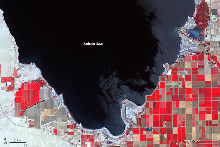
Salton Sea as seen by ASTER

NASA Earth Observatory images by Jesse Allen, using ASTER data from NASA/GSFC/METI/ERSDAC/JAROS, and U.S./Japan ASTER Science Team, and Landsat data from the U.S. Geological Survey.

Fed primarily from agricultural irrigation runoff, the Salton Sea in southern California’s Sonoran Desert has dropped by 8 feet since 1984. While drought in California has contributed to the receding shoreline, water conservation efforts also play a role. The sea may be reduced to two small pools by the 2030s. The Advanced Spaceborne Thermal Emission and Reflection Radiometer (ASTER) on NASA’s Terra satellite captured this image showing the exposed Deltas along its southern shore.

Read the whole article on NASA’s Earth Observatory

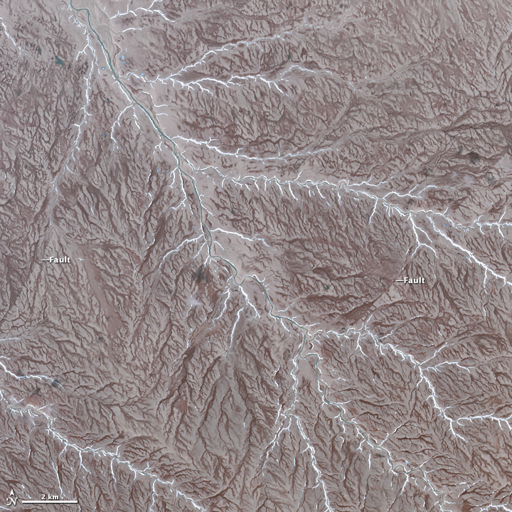
Aster Image of Patrick Island

NASA Earth Observatory image by Jesse Allen, using data from NASA/GSFC/METI/ERSDAC/JAROS, and U.S./Japan ASTER Science Team.

The Advanced Spaceborne Thermal Emission and Reflection Radiometer (ASTER) on NASA’s Terra satellite, captured the image of Prince Patrick Island in Northern Canada. The image was featured on NASA’s Earth Observatory, showing the dendritic drainage pattern of interlocking steam and river channels, as well as, strike-slip faults, evidence of Prince Patrick’s seismic history. Prince Patrick Island is usually surrounded in sea ice, while temperatures average -33 degrees Celcius in January. This cold, inhospitable terrain is not a frequent travel destination, but through satellite imagery, much can be learned about this mostly uninhabited part of our planet.

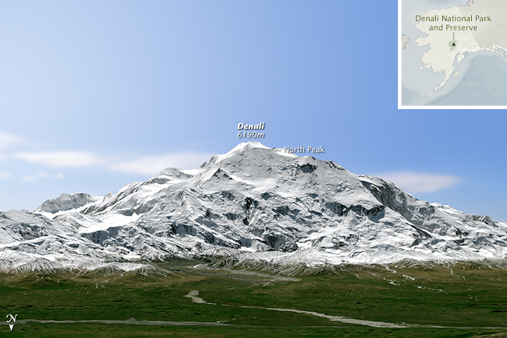
denali_oli_2015166_renderMount Denali received not only a new name on August 30, 2015, it also received a new elevation.  Using the Global Digital Elevation Model (GDEM) product from the Advanced Spaceborne Thermal Emission and Reflection Radiometer (ASTER) data, the listed elevation for Moutn Denali went from 20,320 feet to 20,310 feet. The reduction in elevation was due to a more detailed global elevation survey made possible with the high resolution data from ASTER in the GDEM.  Better technology led to a more accurate elevation.

Read more on NASA’s Earth Observatory

Read the Press Release from USGS

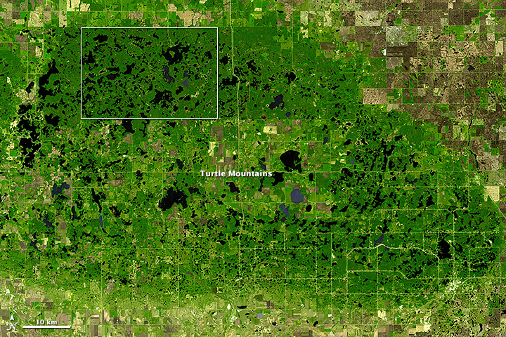
turtlemnts_ast_2006139

Image courtesy NASA/GSFC/METI/ERSDAC/JAROS, and U.S./Japan ASTER Science Team. Caption by Adam Voiland.

In most American states, the Turtle Mountains—which rise 600 to 800 feet (180 to 240 meters) above the surrounding plain—would be called hills. But in North Dakota, one of the flattest states, people have a habit of calling even relatively modest rises mountains. (In the past, the U.S. Board of Geographic Names argued that mountains should have at least 1,000 feet (300 meters) of local relief to earn the designation, but the group abandoned the argument for linguistic consistency in the 1970s.)

Whether hills or mountains, the hummocky highlands that straddle the border between North Dakota and southern Manitoba have enough elevation that they receive significantly more precipitation than the surrounding plains. As shown by this image from the Advanced Spaceborne Thermal Emission and Reflection Radiometer (ASTER) on NASA’s Terra satellite, enough moisture collects on the hills to support forests. The surrounding lowlands are a patchwork of grasslands and farms. In the lower image, a detailed view of a largely undeveloped part of Turtle Mountain Provincial Park, hundreds of ponds and lakes pockmark the landscape. A few roads and oil wells also appear. Read more