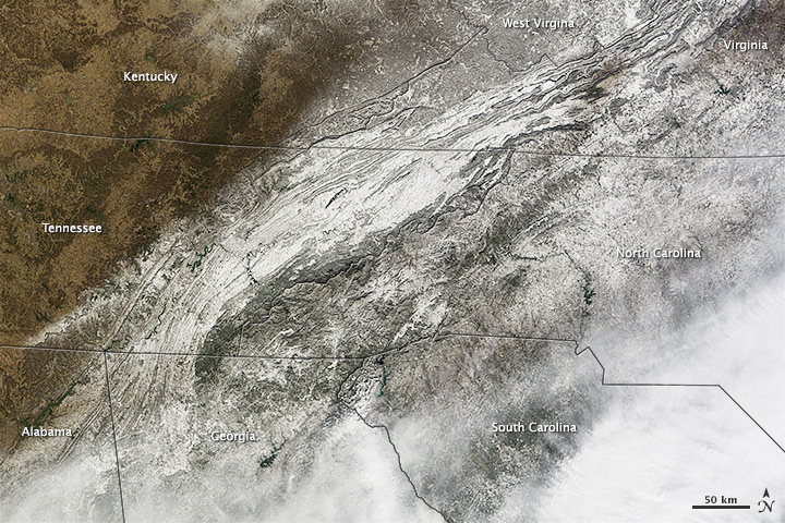
A large winter storm swept through the southeastern United States in January 2014, dropping snow and ice on an area unaccustomed to dealing with winter weather.
While clouds still covered most of the area affected by the storm when the Terra satellite passed over on January 29, 2014, the Moderate Resolution Imaging Spectroradiometer (MODIS) on board captured this view of snow on the ground in parts of northern Georgia, northern South Carolina, eastern Tennessee, and western North Carolina. According to the National Weather Service, the storm dropped up to 9 inches (23 centimeters) of snow in parts of North Carolina, 4 inches (10 centimeters) in parts of South Carolina and Georgia, and 2 inches (5 centimeters) in parts of Tennessee. Atlanta received 2.6 inches (6.6 centimeters) of snow. Many areas also received significant amounts of freezing rain and sleet. Read more
- NASA Earth Observatory image by Jesse Allen and Robert Simmon, using data from the Land Atmosphere Near real-time Capability for EOS (LANCE). Caption by Adam Voiland.


