

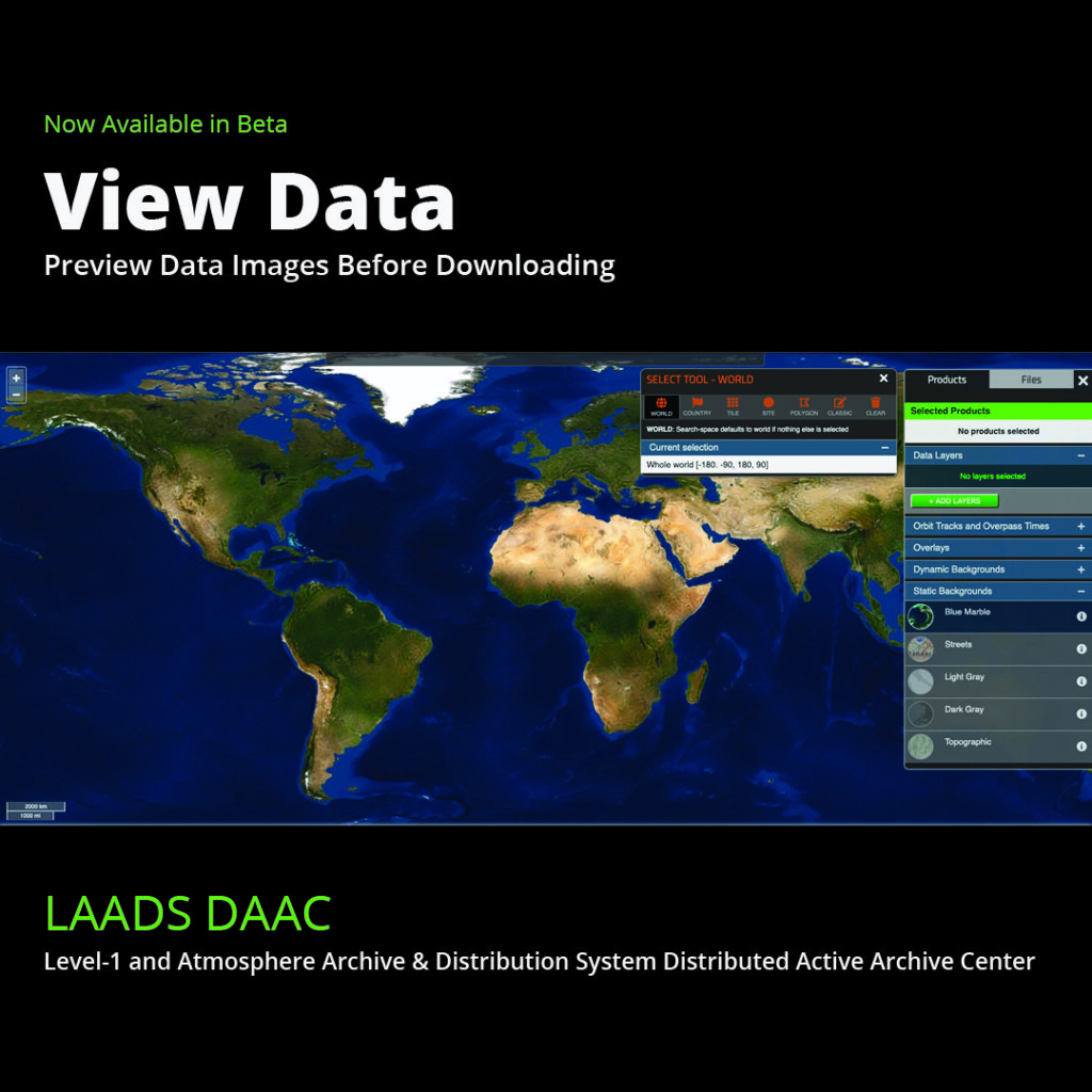
Introducing View Data, a new visual search tool from the Level-1 and Atmosphere Archive and Distribution System Distributed Active Archive Center (LAADSDAAC), that allows users to preview Moderate Resolution Imaging Spectroradiometer (MODIS) and Visible Infrared Imaging Radiometer Suite (VIIRS) atmospheric datasets before downloading.
Click here for a short tutorial on how to use this new tool.
Then, try the new beta version here: https://ladsweb.modaps.eosdis.nasa.gov/view-data
Once you’ve tried it out, let us know what you think here: https://ladsweb.modaps.eosdis.nasa.gov/view-data#feedback
LAADS DAAC is one of the Earth Observing System Data and Information System (EOSDIS) DAACs that manage, archive, and distribute Earth science data as part of NASA’s Earth Science Data Systems (ESDS) program.