Tag: Earth’s Surface and Interior

Earth’s Surface and Interior

NASA image courtesy NASA/GSFC/METI/ERSDAC/JAROS, and U.S./Japan ASTER Science Team. Caption by Adam Voiland.

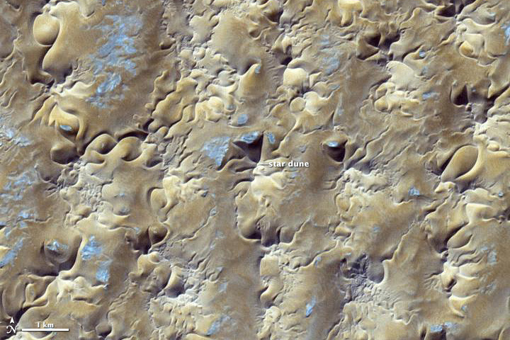
In some areas, winds tend to blow in roughly the same general direction all year. The Grand Erg Oriental, a sprawling sea of sand dunes in the Saharan Desert, is not one of them.

The winds in northeastern Algeria tend to be complex and changing. Easterly summer winds shift in the winter, becoming westerly. Meanwhile, passing storms and local geographical features further muddle the picture. If winds came consistently from one direction, crescent-shaped barchan dunes would reign. But the dominant dune type along the southern edge of Grand Erg Oriental (shown above) are large, pyramid-shaped star dunes, which only form in areas where winds blow from multiple directions.

The image was acquired by the Advanced Spaceborne Thermal Emission and Reflection Radiometer (ASTER) on NASA’s Terra satellite on October 27, 2012. Read more

NASA image courtesy NASA/GSFC/METI/ERSDAC/JAROS, and U.S./Japan ASTER Science Team. Caption by Adam Voiland.
The Rim Fire, near Yosemite National Park, is quickly becoming one of the largest fires in California history.  The Multi-angle Imaging SpectroRadiometer, MISR onboard Terra uses its nine sensors pointed in different directions to collect data on how sunlight scatters across Earth. MISR captured the extensive, brown smoke emerging from the fire.  This data is helping scientists understand how high these smoke plumes rise, disperse, travel, and ultimately affect air quality in other outlying areas.  NPR published an image of the Rim Fire by MISR as it’s image of the week on Sept. 4, 2013.  Read more


The Advanced Spaceborne Thermal Emission and Reflection Radiometer (ASTER) on NASA’s Terra satellite captured this false-color image of the Rim fire burning in and near Yosemite National Park on August 30, 2013. The image, based on ASTER’s observations of visible and infrared light, highlights the contrast between burned and unburned vegetation. Unburned vegetation appears bright red, whereas burned areas are gray. Thick plumes of smoke are also visible billowing from the fire. Read more

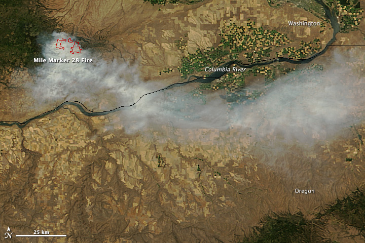
On July 27, 2013, the Moderate Resolution Imaging Spectroradiometer (MODIS) on NASA’s Terra satellite captured this image of the Mile Marker 28 fire burning about 15 miles northeast of Goldendale, Washington. Red outlines indicate hot spots where MODIS detected unusually warm surface temperatures associated with fire. The lower image, a photograph taken by a firefighter on the Washington Incident Management Team 2, shows a column of smoke billowing from the blaze on July 28. Read more

Oklahoma City Tornado Path

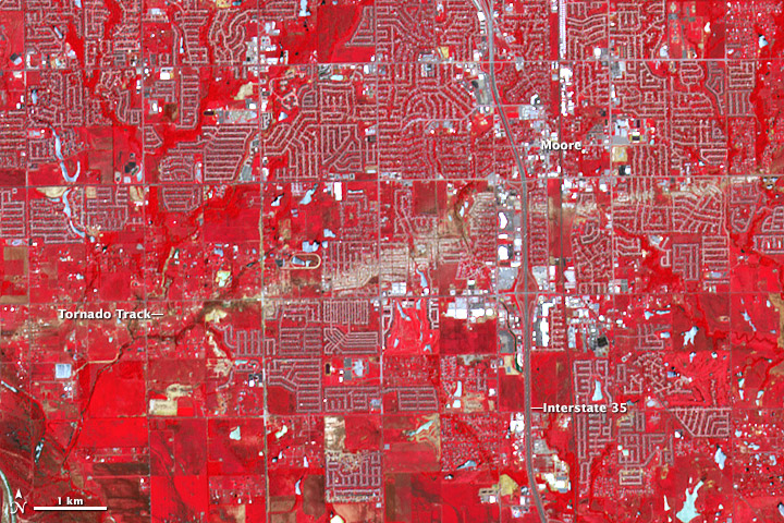
On May 20, 2013, central Oklahoma was devastated by a EF-5 tornado, the most severe on the enhanced Fujita scale. The Newcastle-Moore tornado killed at least 24 people, injured 377, and affected nearly 33,000 in some way. Early estimates suggest that more then $2 billion in damage was done to public and private property; at least 13,000 structures were destroyed or damaged. It was the deadliest tornado in the United States since an EF-5 event killed 158 people in Joplin, Missouri, in 2011. Read more