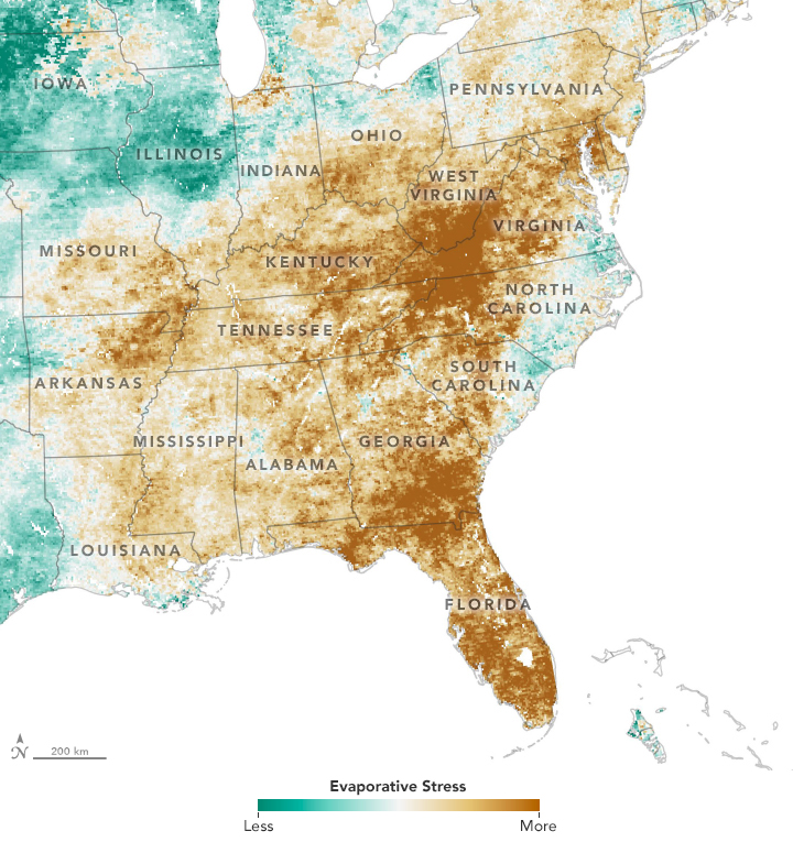
After a wet spring in the eastern United States, a quick-onset drought has parched fields. The maps show Evaporative Stress Index (ESI) data, a drought indicator based on observations of land surface temperatures from National Oceanic and Atmospheric Administration geostationary satellites and on observations of leaf area index from NASA’s Terra and Aqua satellites and the Visible Infrared Imaging Radiometer Suite (VIIRS) on Suomi NPP. The combination makes it possible to gauge evapotranspiration—how much water is evaporating from the land surface and from the leaves of plants.
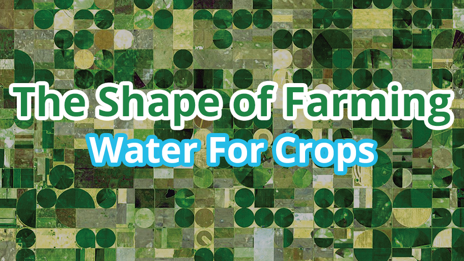
Farmers use a number of different methods to irrigate crops,
and some of them result in pretty interesting shapes. In this issue, The Shape of Farming; Water
for Crops, EO Kids looks at what water has to do with different types of
farming practices, and how these practices look from space. Plus, grow your own
mini-farm and see how your garden grows with this month’s “Data Viz.”
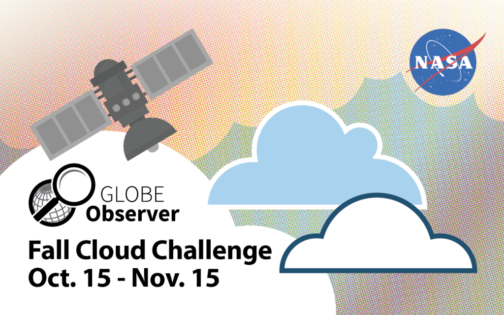
Do you like clouds? Like to help scientists look at MODIS data a little differently…from below? Then join citizen scientists around the globe in the Fall Cloud Challenge. Download the GLOBE Observer app, after registering, tap the clouds protocol icon, and then follow the prompts within the app. Before you know it, you’ll be a cloud expert and be providing valuable data from the ground about what’s up in your sky. The Fall Cloud Challenge runs October 15 – November 15, 2019.
Interested in joining the 2019 NASA Space Apps Challenge?
Are you interested in helping better understand how to track air quality around
the world using NASA data?
You can. Space Apps is an international hackathon for
coders, scientists, designers, storytellers, makers, builders, technologists,
and others in cities around the world, where teams engage with NASA’s free and
open data to address real-world problems on Earth and in space. Space Apps will
take place on October 18‑20,2019.
Terra is supplying useful data from MISR and MODIS for one
challenge: The Surface-to-Air Quality Mission. The challenge is to integrate
NASA data, ground-based air quality data, and citizen science data to create an
air quality surface that displays the most accurate data for a location and
time. Create algorithms that select or weight the best data from several
sources for a specific time and location, and display that information.
Air pollution is associated with almost 5 million annual
deaths worldwide as and costs the global economy $225 billion in lost labor
income and $5 trillion in welfare losses annually. However, in most of the
world, reliable, real-time air quality data are not available. This leaves
people lacking understanding of the air they breathe, that could potentially
have harmful effects.
Read more about the background of the challenge, potential considerations, and explore resources, including Terra data, and help solve a real-world problem using real NASA data. Sign up and good luck!
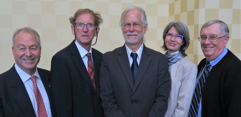
Attending the Oct. 7 awards ceremony were (left to right) Terra team members Michael Abrams, NASA Jet Propulsion Laboratory; James Drummond, Dalhousie University; Robert Wolfe, NASA Goddard Space Flight Center; (far right) Vince Salomonson, University of Utah (retired); and Marie-Josee Bourassa representing the Canadian Space Agency, one of NASA’s partners on the mission. Credits: NASA
The team behind one of NASA’s most productive Earth-observing satellite missions and a leading scientist who has studied the impact of humans on global land cover changes have been honored with the 2019 William T. Pecora Award for achievement in Earth remote sensing.
The awards were presented Oct. 7 at the 21st William T. Pecora Memorial Remote Sensing Symposium and the 38th International Symposium on Remote Sensing of Environment in Baltimore, Md.
The annual award is sponsored by NASA and the Department of the Interior’s U.S. Geological Survey (USGS). First presented in 1974, the Pecora Award recognizes outstanding contributions of individuals and groups toward the understanding of the Earth through remote sensing. The award honors the memory of William T. Pecora, former USGS Director and Interior Under-Secretary.
NASA’s Terra team was recognized with the 2019 group award for significant contributions in all areas of Earth science, with scientific impacts and a legacy that make it one of the most successful missions in NASA’s long line of Earth Observing System satellites. The Terra satellite was launched in 1999 and continues to provide a wide range of global environmental observations.
The team developed innovative techniques to characterize the environmental status and health of our planet. The Terra satellite and its products have appeared regularly in news coverage of tropical storms, natural disasters, snowstorms, and air quality reports.
Terra data have been used by multiple federal agencies for volcanic ash monitoring, weather forecasting, forest fire monitoring, carbon management, and global crop assessment. The Terra team has shown ingenuity and perseverance in developing new calibration methods to increase data quality, ultimately leading to a cohesive long-term record of many environmental quantities with unprecedented accuracy.
Terra has provided a suite of observations that have greatly improved scientists’ understanding of the Earth-atmosphere system. The mission is arguably one of the most successful Earth-sensing satellites ever deployed. More than 19,000 publications using Terra data products have been produced, and the rate of publication has been increasing steadily over the years, demonstrating increased usage of Terra data products by the scientific community.
Thomas Loveland, senior scientist at the U.S. Geological Survey in Sioux Falls, South Dakota, received the 2019 individual Pecora Award for his contributions to the field of Earth science.Credits: U.S. Geological Survey
The 2019 individual award was presented to Thomas R. Loveland for his outstanding contributions to the field of Earth science as a leading USGS scientist and chief scientist at the USGS Earth Resources Observation and Science Center. Loveland has devoted his career to understanding how the Earth’s surface is changing through mapping and monitoring land cover and land use, which has resulted in groundbreaking global land cover research.
Loveland’s work has paid particular attention to the impact of human activities on land cover. He has been involved in capacity building nationally and internationally, for example, through the Famine Early Warning Systems Network in Africa, which saves human lives by directing response to areas impacted by famine and informing preparation for future famine.
Loveland has led the development of innovative monitoring programs, produced exciting new land cover and land use change products. He has steered efforts to improve the Landsat satellite missions, ensuring that the data are freely available to the entire community. He led the International Geosphere-Biosphere Programme global land cover effort, which brought to fruition the first truly global effort to map land cover with remote sensing.
Loveland has been a leader in the development of multiple operational programs for land cover mapping and monitoring in the United States. From 2006 to 2016, he served as co-lead for the NASA/USGS Landsat Science Team, where his innovative and visionary ideas advanced land-imaging science and future Landsat mission planning.
For six decades, NASA has used the vantage point of space to understand and explore our home planet, improve lives and safeguard our future. NASA’s observations of Earth’s complex natural environment are critical to understanding how our planet’s natural resources and climate are changing now and could change in the future.