

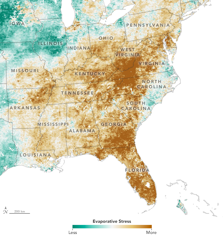
After a wet spring in the eastern United States, a quick-onset drought has parched fields. The maps show Evaporative Stress Index (ESI) data, a drought indicator based on observations of land surface temperatures from National Oceanic and Atmospheric Administration geostationary satellites and on observations of leaf area index from NASA’s Terra and Aqua satellites and the Visible Infrared Imaging Radiometer Suite (VIIRS) on Suomi NPP. The combination makes it possible to gauge evapotranspiration—how much water is evaporating from the land surface and from the leaves of plants.
https://earthobservatory.nasa.gov/images/145762/a-flash-drought-dries-the-southeast