

 NASA image courtesy of the LANCE/EOSDIS MODIS Rapid Response Team at NASA GSFC. Caption by Adam Voiland.
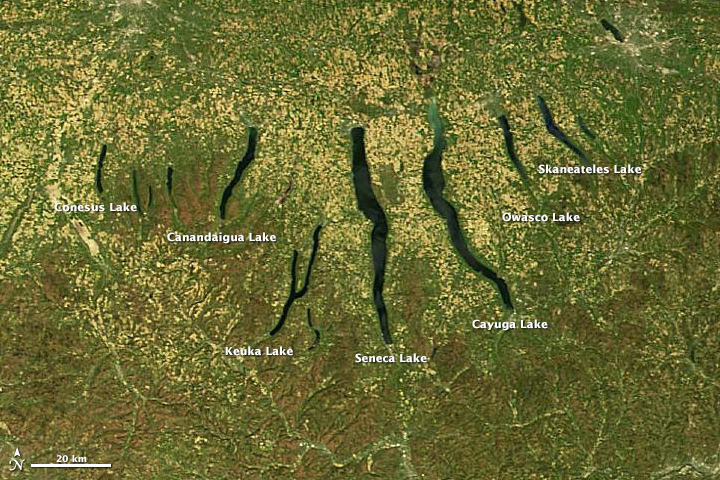
The Finger Lakes-a group of long, roughly parallel lakes in upstate New York-got their name for obvious reasons. On a map, the narrow lakes look similar to outstretched digits. Seneca and Cayuga-the two largest Finger Lakes-are among the deepest lakes in North America. Lake Cayuga descends about 435 feet (133 meters) at its deepest point-putting it about 53 feet (16 meters) below sea level.
On May 6, 2013, the Moderate-resolution Imaging Spectroradiometer (MODIS) on NASA’s Terra satellite acquired this true-color image of the Finger Lakes. Read more