Image from TERRA
Tue, 18 Apr 2023 16:24 EDT

The Valley of Ten Thousand Smokes, located in Katmai National Park, forms a unique and ashen landscape. Encircled by volcanoes – both active and inactive – it has served as a perfect collection area for huge amounts of volcanic ash.

Image from TERRA
Tue, 20 Sep 2022 10:30 EDT

Water departments in the West are using maps and models originally created by a NASA team to help track water.

Image from TERRA
Thu, 15 Sep 2022 10:00 EDT

NASA and Google broadened an existing partnership to help local governments improve their monitoring and prediction of air quality for better decision making.

Flooding in Iraq

20 November, 2015

turkey_Iraq_tmo_2015315

NASA Earth Observatory images by Joshua Stevens and Adam Voiland, using MODIS data from LANCE/EOSDIS Rapid Response and Landsat data from the U.S. Geological Survey.

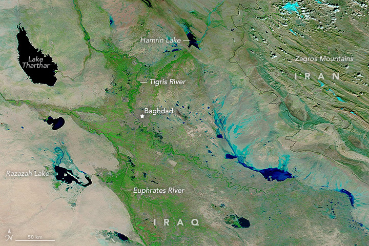
Torrential rains in late October 2015 resulted in flooding in Iraq, prompting authorities to declare a state of emergency. Widespread power outages, overflowing sewers, and flooded streets displaced almost 84,000 people, according to news reports. The image from the Moderate Imaging Spectroradiometer (MODIS) on NASA’s Terra satellite, featured on NASA’s Earth Observatory, shows the flooding.

To see before and after images and read the whole article visit NASA’s Earth Observatory.


Tagged with: ,