

NASA image courtesy Jeff Schmaltz, LANCE MODIS Rapid Response Team at NASA GSFC. Caption by Adam Voiland, with information from Daniel Lindsey (NOAA) and Rick McRae (Australian Capital Territory Emergency Services Agency).
The intense bushfires that strike southern Australia in the summer usually attract the most headlines, but the country’s largest and most frequent blazes actually occur in northern Australia in the spring. In fact, in terms of sheer area burned, satellite observations show that over 98 percent of large fires in Australia occur well outside of densely populated southeastern and southwestern parts of the country.
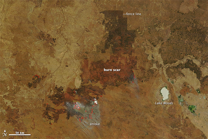
A fire that began burning in Northern Territory on September 10, 2014, offers a prime example of just how expansive fires from this part of the continent can become. After racing through grasslands for just a few weeks, the fire had charred an area about the size of Massachusetts by October 8, 2014.
The Moderate Resolution Imaging Spectroradiometer (MODIS) on NASA’s Terra satellite captured this sequence of images showing the progression of the fire. Read more