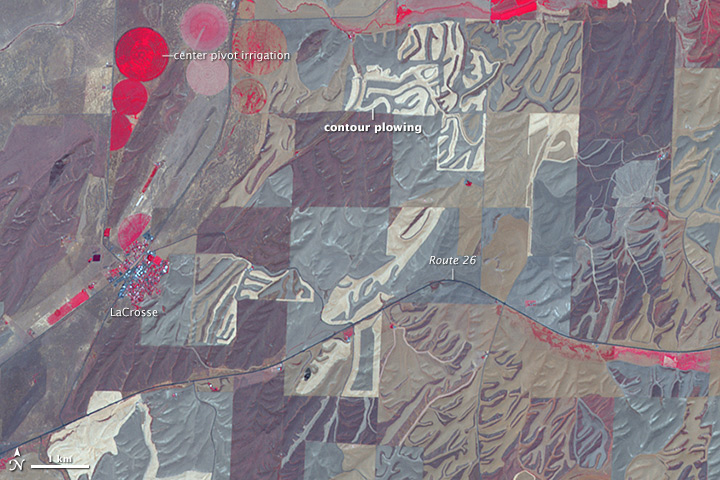
NASA image created by Jesse Allen, using data provided courtesy of NASA/GSFC/METI/ERSDAC/JAROS, and U.S./Japan ASTER Science Team. Caption by Adam Voiland.
The Advanced Spaceborne Thermal Emission and Reflection Radiometer (ASTER) on NASA’s Terra satellite captured this image of farmland near LaCrosse, Washington, on July 24, 2008. The false-color image was assembled using infrared, red, and green wavelengths of light. This combination is useful for observing vegetation and monitoring its health. Areas with the most vigorous crops, grasses, and trees are bright red. Areas where vegetation is drying or dormant are darker shades of brown and gray. Areas with no red are likely fallow or being prepared for seeding. Read more

