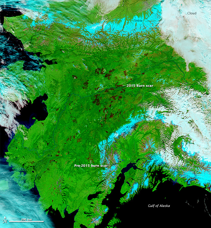
 Alaska is experiencing it’s second most severe fire season since 1950 with over 5.2 million acres burned (the average is 800,000 acres per year).
Terra and Aqua Moderate Imaging Spectroradiometer (MODIS) are useful for scientists and land managers to be able to monitor and asses the environmental impact of remote forest fires. This allows groups like the scientists from Universtity of California, Irvine, and Woods Hole Research Center to publish and analysis of carbon emissions for Alaska’s boreal forests. In addition land managing agencies are able to monitor fires unpopulated areas and allow them to burn, freeing up limited resources to be used in highly populated areas.

