Year: 2020

-Kurt Thome, Terra Project Scientist
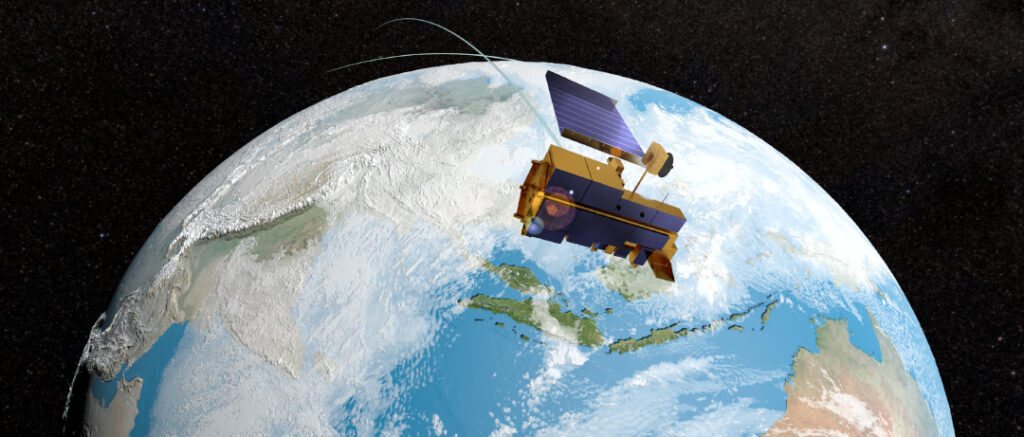
On February 27, 2020, the Terra flight operations team conducted Terra’s last inclination adjust maneuver.   The inclination adjust maneuver is one of three basic maneuvers requiring fuel that the Terra Flight Operations Team uses to maintain Terra’s orbit and the safety of the platform.  Inclination adjust maneuvers are used to control the platform’s mean local time (MLT) of its equator crossing.  The other two are drag makeup maneuvers (DMUs) to control the orbital altitude (apogee and perigee) and risk mitigation maneuvers (RMM), or debris avoidance maneuver (DAMs), that are used to protect the platform from collisions with known on-orbit debris or other spacecraft.

The importance of orbit maintenance is that changes in orbit can affect the quality of data from a sensor.  Earlier crossing times for a morning platform like Terra mean lower solar elevations (leading to more prevalent shadows), decreased cloud probabilities, lower surface temperatures, and lower reflected energy (leading to lower signals).  A decrease in orbit altitude alters the spatial coverage of the sensor including possible gaps in spatial sampling, decreased spatial coverage, but better spatial resolution. 

The flight operations team works to maintain both crossing time and platform altitude to provide the highest quality data.  The trade is that fuel is often a life-limiting factor for long-life platforms.  The amount of maneuvering fuel is a trade between platform weight at launch, expected platform life, and safe disposal of the platform at end of life. Fuel use is dominated by inclination maneuvers since they require significantly more fuel than drag makeup maneuvers.

Fortunately, Terra benefited from a near perfect launch and accurate orbit insertion by the launch vehicle leading to almost a full tank of fuel for maneuvering.  Inclination maneuvers have been done on average four times per year since launch to maintain Terra’s crossing time of 10:30 am (though it was 10:45 am for the first two years on orbit).  IAMs continued until the remaining fuel was just enough for a Constellation Exit and perigee-lowering burns.  The Constellation Exit lowers the platform’s orbit by 6 km to remove it from the 705-km orbit altitude of the Earth Sciences Constellation.  The perigee-lowering burns take place at the time of Terra’s passivation and all remaining fuel is used to lower Terra to begin its slow re-entry to an uncontrolled de-orbit.

After Terra’s IAM it began to drift to an earlier crossing time.  Drag makeup maneuvers are being continued to maintain Terra’s orbit altitude of 705 km.  Risk mitigation maneuvers will also continue to avoid orbital debris.  When Terra’s crossing time reaches a 10:15 AM MLT (currently predicted for October 2022), the flight operations team will have Terra exit the Earth Sciences Constellation and lower Terra to an altitude of 694 km by performing two retrograde maneuvers. Risk mitigation maneuvers continue, but no further drag make up maneuvers will take place and Terra will slowly decrease in altitude as well as continue drifting to an earlier MLT crossing.  It is predicted to reach a crossing time of 9:00 am in December 2025 at which point the perigee-lowering burns will take place to lower Terra by an additional 20 km.

Terra’s instruments will continue to be operational during this entire process.  The impacts of the changing crossing time are expected to be minimal and will impact the data from each of Terra’s five instruments in a slightly different fashion.  To learn more about the effects please visit the individual instrument websites. 

ASTER

CERES*

MISR

MODIS

MOPITT

*Information regarding impacts to instruments is still pending.

Key Dates of Drift

  • Exceed 10:30 MLT (+/- 1 min) – April 2021*
  • Exceed 10:15 MLT – September 2022*
  • Constellation Exit – September 2022*
  • Exceed 9:00 MLT– December 2025*

Passivation is expected to take place due to signal to noise limits from lower solar zenith angles, limited battery power from changing solar angle on the solar panels, or programmatic funding limits.

*Dates are subject to change.

Bighorn Fire north of Tucson, Arizona, on June 29
NASA’s Advanced Spaceborne Thermal Emission and Reflection Radiometer (ASTER) instrument imaged areas burned by the Bighorn Fire north of Tucson, Arizona, on June 29. Vegetation is shown in red and burned areas are shown in dark gray. It covers an area of 20 by 30 miles (33 by 48 kilometers). Credit: NASA/JPL-Caltech
› Larger view

From the vantage point of the Terra satellite, the instrument can detect the scarred land that the wildfire, burning north of Tucson, is leaving in its wake.


On the night of June 5, a lightning strike started the Bighorn Fire in the Santa Catalina Mountains north of Tucson, Arizona. Extremely dry vegetation and windy conditions caused the fire to spread quickly. By June 30, the multi-agency incident information system, InciWeb, reported that it had ballooned to more than 114,000 acres and that it was about 45% contained.

NASA’s Advanced Spaceborne Thermal Emission and Reflection Radiometer (ASTER) instrument aboard the Terra satellite imaged some of the burned area on June 29. In this image, vegetation is shown in red and burned areas appear dark gray. It covers an area 20 by 30 miles (33 by 48 kilometers).

Efforts to contain the fire continue with 21 hand crews, 10 helicopters and dozens of fire engines deployed to the area. Smoke impacts to surrounding communities are being carefully monitored.

With its 14 spectral bands from the visible to the thermal infrared wavelength region and its high spatial resolution of about 50 to 300 feet (15 to 91 meters), ASTER images Earth to map and monitor the changing surface of our planet. It is one of five Earth-observing instruments launched Dec. 18, 1999, on Terra. The instrument was built by Japan’s Ministry of Economy, Trade and Industry. A joint U.S./Japan science team is responsible for validation and calibration of the instrument and data products.

The broad spectral coverage and high spectral resolution of ASTER provides scientists in numerous disciplines with critical information for surface mapping and monitoring of dynamic conditions and temporal change. Example applications are monitoring glacial advances and retreats; monitoring potentially active volcanoes; identifying crop stress; determining cloud morphology and physical properties; wetlands evaluation; thermal pollution monitoring; coral reef degradation; surface temperature mapping of soils and geology; and measuring surface heat balance.

The U.S. science team is located at NASA’s Jet Propulsion Laboratory in Southern California. The Terra mission is part of NASA’s Science Mission Directorate, Washington.

This story originally appeared on https://www.jpl.nasa.gov

News Media Contact

Ian J. O’Neill / Jane J. Lee
Jet Propulsion Laboratory, Pasadena, Calif.
818-354-2649 / 818-354-0307
ian.j.oneill@jpl.nasa.gov / jane.j.lee@jpl.nasa.gov
Written by Esprit Smith, NASA’s Earth Science News Team

MOPITT U.S. Principal Investigator, Helen Worden, along with MOPITT scientists, Sara Martínez-Alonso, Mijeong Park, and Laura Pan, published an article about how the National Center for Atmospheric Research’s (NCAR) Atmospheric Chemistry Observations and Modeling (ACOM) group is using MOPITT data to see the impact of COVID-19 on air quality in China. Read their full article from NCAR’s ACOM.

ACOM article link: https://www2.acom.ucar.edu/news/covid-19-impact-asian-emissions-insight-space-observations

Other media sources:

In order to improve the accuracy of data and gain insights that would be difficult to achieve with one instrument alone, researchers have started combining data from Terra’s five instruments: ASTER, CERES, MISR, MODIS, and MOPITT. The result, Terra Fusion, a new dataset and toolkit. Read more https://earthdata.nasa.gov/learn/articles/tools-and-technology-articles/introducing-terra-fusion

Dr. Kurt Thome, Terra Project Scientist was featured in a Data Chat – short, informal discussions with scientists, managers, and members of NASA’s diverse data-user community. Thome provides personal insights into how Terra data are being used around the world, along with a glimpse into how these data, products, and services may be used in the future. Read more https://earthdata.nasa.gov/learn/data-chat/data-chat-dr-kurt-thome.