

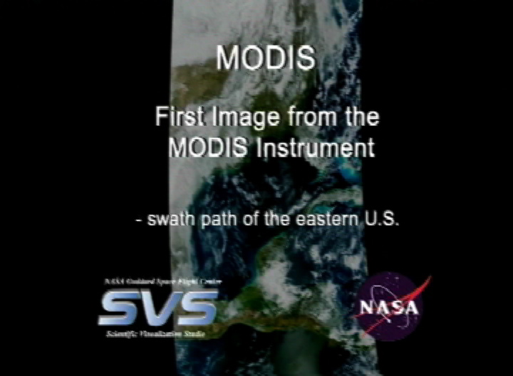
On February 24th, 2000, the Terra satellite collected its very first data, known in the science community as “First Light” imagery from the MODIS instrument; and in the following March, “First Light” imagery was captured from Terra’s other four instruments. These images were combined by NASA’s Scientific Visualization Studio into two “First Light” animations, shown below.
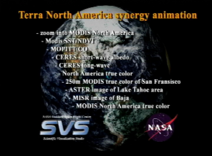
Twenty-five years later, we’re celebrating over 9,000 days of Earth imagery taken by Terra since then, with a new animation that incorporates the first MODIS swath, plus imagery and stories by NASA’s Earth Observatory team that align with the same regions captured in the original “First Light” animation.
Featured Earth Observatory Imagery & Stories in this video:
Click for full list below.
- Allen, J. (2004, July 30). Smoke from Alaska Fires. NASA Earth Observatory. https://earthobservatory.nasa.gov/images/13459/smoke-from-alaska-fires
- Allen, J. (2007, August 11). Summer on Lake Superior. NASA Earth Observatory. https://earthobservatory.nasa.gov/images/7951/summer-on-lake-superior
- Allen, J., & Riebeek, H. (2008, June 24). Floods in the U.S. Midwest. NASA Earth Observatory. https://earthobservatory.nasa.gov/images/20048/floods-in-the-us-midwest
- Allen, J., & Scott, M. (2011, May 5). Tornado Damage near Birmingham, Alabama. NASA Earth Observatory. https://www.earthobservatory.nasa.gov/images/50462/tornado-damage-near-birmingham-alabama
- Allen, J., & Voiland, A. (2017, August 24). Hurricane Harvey Stirs Up the Gulf of Mexico. NASA Earth Observatory. https://earthobservatory.nasa.gov/images/90818/hurricane-harvey-stirs-up-the-gulf-of-mexico
- Dauphin, L., & Voiland, A. (2019a, March 20). Flooding on the Lower Mississippi Continues. NASA Earth Observatory. https://earthobservatory.nasa.gov/images/144701/flooding-on-the-lower-mississippi-continues
- Dauphin, L., & Voiland, A. (2019b, July 8). Smoke Spreads Across Ontario. NASA Earth Observatory. https://earthobservatory.nasa.gov/images/145289/smoke-spreads-across-ontario
- Dauphin, L., & Voiland, A. (2022, May 19). Spotting Severe Storms with Satellites. NASA Earth Observatory. https://earthobservatory.nasa.gov/images/149846/spotting-severe-storms-with-satellites
- Descloitres, J. (2002, May 10). Whiting of Lake Erie. NASA Earth Observatory. https://earthobservatory.nasa.gov/images/9487/whiting-of-lake-erie
- Fires in Mexico and Central America. (2003, March 31). NASA Earth Observatory. https://earthobservatory.nasa.gov/images/10987/fires-in-mexico-and-central-america?src=ve
- Floods in the Midwestern United States. (2007, May 15). NASA Earth Observatory. https://earthobservatory.nasa.gov/images/18356/floods-in-the-midwestern-united-states
- Haze Over the Midwestern United States. (2005, September 12). NASA Earth Observatory. https://earthobservatory.nasa.gov/images/15323/haze-over-the-midwestern-united-states
- Lake Effect Snow in the United States. (2006, December 12). NASA Earth Observatory. https://earthobservatory.nasa.gov/images/17770/lake-effect-snow-in-the-united-states
- Liang, W., & Doermann, L. (2023, June 17). James Bay Melts Out. NASA Earth Observatory. https://earthobservatory.nasa.gov/images/151472/james-bay-melts-out
- Mississippi River – ASTER Image Gallery. (2017). NASA/METI/AIST/Japan Space Systems, and U.S./Japan ASTER Science Team. https://asterweb.jpl.nasa.gov/gallery-detail.asp?name=mississippimap
- NASA’s ASTER Captures Lava Flow, Ash from Guatemala Volcano. (2018, December 3). NASA Jet Propulsion Laboratory (JPL); NASA/METI/AIST/Japan Space Systems, and U.S./Japan ASTER Science Team. https://www.jpl.nasa.gov/images/pia22820-nasas-aster-captures-lava-flow-ash-from-guatemala-volcano/
- New Orleans after Katrina – ASTER Image Gallery. (2025). NASA/METI/AIST/Japan Space Systems, and U.S./Japan ASTER Science Team. https://asterweb.jpl.nasa.gov/gallery-detail.asp?name=neworleans
- O’Neill, I., Lee, J., & Richmond, J. (2020, August 29). Terra MISR Used to Visualize Cloud-top Heights From Tropical Storm Laura in 3D. NASA Jet Propulsion Laboratory (JPL). https://www.nasa.gov/centers-and-facilities/jpl/terra-misr-used-to-visualize-cloud-top-heights-from-tropical-storm-laura-in-3d/
- Pacaya and Fuego Volcanoes, Guatemala. (2021, March 5). NASA Jet Propulsion Laboratory (JPL); NASA/METI/AIST/Japan Space Systems, and U.S./Japan ASTER Science Team. https://www.jpl.nasa.gov/images/pia24419-pacaya-and-fuego-volcanoes-guatemala/
- Perkins, L. (2014, December 17). Link between Sea-Ice Fraction and Absorbed Solar Radiation over the Arctic Ocean. NASA Scientific Visualization Studio. https://svs.gsfc.nasa.gov/4245
- Schmaltz, J. (2003, March 12). Ice Covers the Great Lakes. NASA Earth Observatory. https://earthobservatory.nasa.gov/images/3280/ice-covers-the-great-lakes
- Schmaltz, J. (2005, September 22). Hurricane Rita. NASA Earth Observatory. https://earthobservatory.nasa.gov/images/15550/hurricane-rita
- Schmaltz, J. (2007, September 29). Fall Color Around Lake Superior. NASA Earth Observatory. https://earthobservatory.nasa.gov/images/8084/fall-color-around-lake-superior
- Schmaltz, J., & Lindsey, R. (2008, December 13). Rare Snow in the U.S. Deep South. NASA Earth Observatory. https://earthobservatory.nasa.gov/images/36161/rare-snow-in-the-us-deep-south
- Schmaltz, J., & Simmon, R. (2014, March 5). Pacaya Volcano. NASA Earth Observatory. https://earthobservatory.nasa.gov/images/83278/pacaya-volcano