

NASA Earth Observatory images by Jesse Allen, using ASTER data from NASA/GSFC/METI/ERSDAC/JAROS, and U.S./Japan ASTER Science Team, and Landsat data from the U.S. Geological Survey.
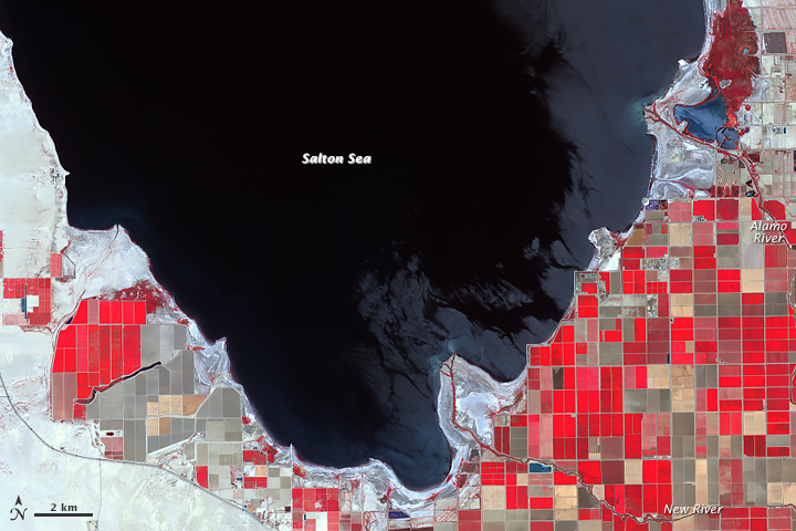
Fed primarily from agricultural irrigation runoff, the Salton Sea in southern California’s Sonoran Desert has dropped by 8 feet since 1984. While drought in California has contributed to the receding shoreline, water conservation efforts also play a role. The sea may be reduced to two small pools by the 2030s. The Advanced Spaceborne Thermal Emission and Reflection Radiometer (ASTER) on NASA’s Terra satellite captured this image showing the exposed Deltas along its southern shore.
Read the whole article on NASA’s Earth Observatory